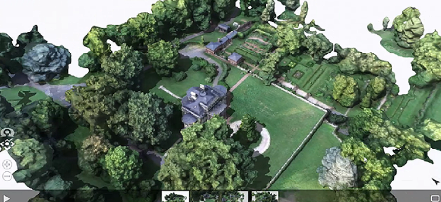
Esri introduces Drone2Map to process aerial images


Connecting state and local government leaders
Drone2Map incorporates a powerful image-processing engine from Pix4D to analyze images taken from drones and convert them into a variety of 2-D and 3-D maps.
Reinventing the wheel is silly. But putting a set of them on your cart is smart.
That’s what Esri is doing with Drone2Map, a beta application that was opened for public download Feb. 24. Drone2Map incorporates Pix4D’s powerful image-processing engine to analyze images taken from drones and convert them into a variety of 2-D and 3-D maps.
“Pix4D has been doing that for number of years,” said Kurt Schwoppe, Esri’s business development manager for imagery. So Esri decided to build that photogrammetric engine into its ArcGIS platform, he said.
While Drone2Map is integrated into ArcGIS, it is designed primarily for work in the field. Once a drone lands and the camera’s images are transferred to a laptop equipped with Drone2Map, the program will run a preprocess analysis on lower-resolution samples from the image set to determine whether the captured images have the data required to determine location and to make measurements of features.
“We will take advantage of as much data as we can find in the image stream” or whatever data users have to go along with the images, Schwoppe said. “At a minimum we need the X and Y location of where the photo was taken, and it very much helps to have the altitude where the photo was taken.”
Beyond that, Schwoppe said, the software needs to know tip, tilt and angle of the camera itself.
Unfortunately, some of the low-end commercial drones don’t have sensors to record all of that information. In that case, Schwoppe said, Drone2Map will make educated guesses by examining features in the imagery. With enough overlapping images, the system can recognize landmarks, analyze the changing angles and sizes in the sequence and deduce the location and orientation of the camera in space, he said.
The main benefit of preprocessing is that the user discovers right away if the drone needs to be sent aloft again for another image-gathering expedition, instead of finding out only after full processing back in the office.
“Preprocessing tells you whether you have a good solution before you go into the heavy processing to complete the final product,” Schwoppe said.
The final products delivered by Drone2Map include digital surface models, 3-D point clouds and meshes as well as orthomosaics, which are stitched images that have been geolocated and corrected for distortions that result from varying camera locations.
And while the resulting maps can be loaded into ArcGIS desktop software for further analysis and processing, one cool feature of Drone2Map is that the user can move maps directly to the ArcGIS Online web maps or 3-D PDF files while still in the field.
According to Schwoppe, another option for Drone2Map output is “inspection photos” for electrical transmission or cell phone towers, wind turbines, pipelines, the face of a hydroelectric dam or the hull of a ship or the underside of a bridge.
“We actually take oblique images around the target of interest, then we put the photogrammetric smarts behind the imagery, and it allows you to do precise measurements on the non-distorted photo,” Schwoppe said. “If you have a cell phone tower or something like that you need to inspect you can go in and collect the imagery and use this inspection tool to do any kind of measurements or analysis of the target in question.”
Drone2Map beta software is available for free public download. According to Schwoppe, Esri expects the release version of Drone2Map to be ready by June, when it will be offered as a subscription service.


