Making UAVs more maneuverable


Connecting state and local government leaders
Georgia Tech's Rotorcraft Center of Excellence is developing guidance technologies to allow unmanned aerial vehicles to fly more efficiently and safely.
As the day rapidly approaches when unmanned aerial vehicles (UAVs) are going to be sharing domestic airspace with other aircraft and obstacles such as power lines, windmills and buildings, Georgia Tech’s Rotorcraft Center of Excellence is developing guidance technologies to allow them to fly more efficiently and safely.
Not surprisingly, much of the research is being done with funding from the military, but the implications for domestic uses are equally important, particularly when it comes to ensuring safe operations in increasingly crowded airspace.
As part of its five-year project called the Vertical Lift Research Center of Excellence – funded by the Army and Navy – the Georgia Tech team ran tests in late June at Fort Benning on software developed to guide an unmanned helicopter at high speeds through terrain at low altitudes.
According to Eric Johnson, associate professor of avionics integration at Georgia Tech’s
School of Aerospace Engineering, the military’s immediate interest is in developing technology that can allow the UAVs to fly without being observed by the enemy.
“We use a terrain sensor that senses were obstacles are,” Johnson said. “It can see out about 200 feet. We’ve been using that in real-time to plan where the aircraft goes so they can fly at high speed at low altitude to prevent detection.”
Obviously, the faster and lower the UAV can navigate, the less likely it is to be observed. “But there are some really interesting trade-offs,” Johnson said. “If you try to go too fast you really can’t get down very low anymore because you’re going too fast.”
In addition to developing software to maximize high-speed, low-altitude navigation, the team is refining its model for computing the likelihood of the UAV being observed from all the potential ground points.
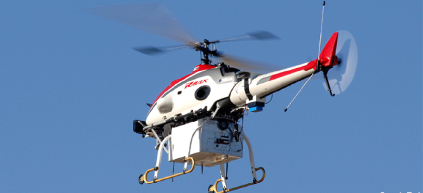
In current tests with a Yamaha R-Max helicopter, an operator specifies the desired altitude and speed. “But we want to have the automation optimize the observability instead, so that it picks the speed and altitude,” Johnson said.
At the Fort Benning exercises, the Georgia Tech team also tested a guidance system for delivering and dropping payloads.
The same Yamaha R-Max helicopter was outfitted with a sling to carry a 35-pound payload. At pre-specified locations, the on-board computer triggered the release of the payload.
According to Johnson, the team still has work to do. “We tested our guidance system in benign maneuvers, moving very slowly, and it worked fine,” he said. “But we found that the estimator wasn’t working well enough to go much faster so we are going to have to work on that.”
NEXT STORY: DARPA to test devices that help restore memory


