NASA drone traffic management system passes first tests


Connecting state and local government leaders
NASA recently field-tested its UAS traffic management system for low-flying drones in rural environments.
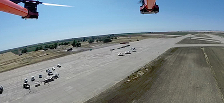
NASA recently concluded successful demonstrations of its unmanned aerial systems traffic management (UTM) system at a remote airfield south of Modesto, Calif.
NASA’s UTM aims to serve as an air traffic control system for low-flying drones, roughly similar to ground traffic systems that consist of roads, lanes, stop signs, rules and lights.
“UTM is designed to enable safe, low-altitude civilian UAS operations by providing pilots information needed to maintain separation from other aircraft by reserving areas for specific routes, with consideration of restricted airspace and adverse weather conditions,” said Parimal Kopardekar, NASA’s manager of Safe Autonomous Systems Operations project and NASA’s UTM lead.
The UTM will be a cloud-based system with four levels of progressively more capable technology, NASA said. Depending on the operational environment, the system will include different components.
NASA’s recent tests in rural environments fall under the first category, or Technical Capability Level One, which includes flights associated with agriculture, firefighting and infrastructure monitoring. The second stage, focusing on applications that operate beyond visual line of sight, will not be demonstrated until October 2016. Level three will include “cooperative and uncooperative UAS tracking” over moderately populated areas and is planned for January 2018. The final level, which involves UAVs in higher-density urban areas, will not be tested until 2019.
Under the first level of capabilities, NASA envisions technologies that allow operators to file flight plans and reserve airspace while simultaneously providing situational awareness of other nearby operations.
While the NASA tests mostly focused on flight plan submission and flight plan approvals, industry partners, such as Harris, Lockheed, PrecisionHawk and Verizon, also conducted tests on real-time tracking.
Prior to test flights, a weather tower, small ground stations, an Automatic Dependent Surveillance-Broadcast in-ground relay station and a radar station were built at a remote airfield to monitor flights and collect data. Flights were monitored with radar, cellular signals, ADS-B and GPS, which provided insight into the reliability, accuracy and delay associated with the positions the aircraft reports.
During the tests, the UTM was able to recognize the live and virtual aircraft and responded using messages and alerts to the vehicles, NASA said. Flying within preprogrammed goefences, the operators also produced data that will help researchers develop navigational performance metrics for the UTM.
The first level of NASA’s UTM can be ready to be deployed, according to Tyler Collins, Managing Director of Airspace Safety at PrecisionHawk. In fact, commercial UTMs such as PrecisionHawk’s Low Altitude Traffic and Airspace Safety platform is already in use. While continued testing is still necessary, current UTM capabilities are being built from components of previous tests, Collins said,.
As a result of the recent tests for Technical Capability Level One, NASA has created implementation and integration guidelines as well as lessons learned for deploying UTM in rural environments. Despite an incremental schedule for various environments, each capability level is independent and deployable, NASA said in a presentation at the UTM convention earlier this year.
That means the capabilities can be used as they’re developed as part of an incremental process, Collins said. The development phases are independent in that NASA does not have to wait to use or deploy Level One prior to testing for Level Two.
Challenges going forward include incorporation of communication systems and its infrastructure. “We have to evaluate the existing communication systems,” Collins said, explaining that when communications companies “built the [cellular] network to work for everybody on the ground, they didn’t build the network to work for everybody [at] 400 feet – it turns out it works very well at 400 feet.” Verizon and other communications companies are collecting data to improve their systems in the next few years, he said.
However, despite the multitude of technologies involved, they can tie into the existing infrastructure and air traffic control systems, Collins said, noting that the wheel does not have to be reinvented. The number of manufacturers integrating into this system during the recent tests demonstrates how easily these technologies could be integrated across the board, he said.
For the Federal Aviation Administration, Collins told GCN its role as a regulating body is to collect data from tests and members of industry to better inform decision making in crafting regulations. The next step is beyond line of sight operations, and the FAA will be collecting data to inform regulation of this capability.
NASA will be providing the Technical Capability Level One to Federal Aviation Administration test sites for further validation.
“Based on the results, we will develop airspace integration performance requirements for stakeholders and FAA,” a NASA spokesperson said in an email. “FAA will make the decisions about how best to allow operations.” Additional tests slated for the spring of 2016 will be conducted at these FAA test sites and will include more vehicles, trajectory configurations and users to ensure safe UAS integration.


