How transparency and visibility are reshaping public safety


Connecting state and local government leaders
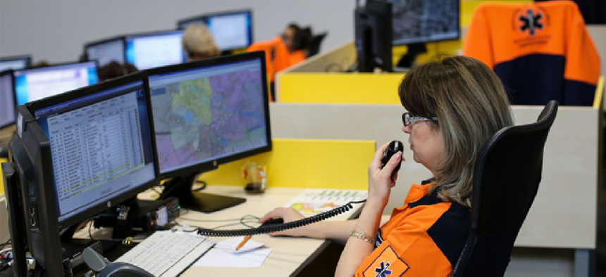
With a cloud-based, interoperable emergency response system, dispatchers can better analyze location data to deliver immediate, life-saving aid.
Lines and borders have long been associated with safety and protection. Crosswalks designate areas where pedestrians can safely walk across the flow of traffic. Property borders distinguish land ownership and discourage trespassing. Fences help keep intruders at bay and children and pets safely on a property. Even in IT, a virtual line separates on-premise, server-based solutions from cloud-based options.
But lines and borders aren’t always helpful, especially when they hinder information sharing and transparency among public agencies. In fact, agencies are realizing that working across borders leads to greater resource optimization and, as a result, safer communities.
Sharing data lessens limitations
Disparate recordkeeping and dispatch systems impose limitations on emergency response, especially since emergency situations know no borders. Greater access to data can help agencies dispatch public safety personnel closest to an event, regardless of district lines.
Technological developments have created environments where interoperability is not only possible, but easy. Recent advances in officer-specific technologies have given agencies greater visibility into responder locations, statuses and even capabilities, so commanders can know, for example, if they are equipped to handle specific events. When combined with advanced data sharing across public safety networks, dispatchers can send the closest and most prepared responder to the emergency at hand.
Interoperability in action
This emergent technology shows that safety isn’t limited by an agency’s district lines. The ability to monitor the locations of responders from neighboring districts to a raging fire or a multi-vehicle accident in real-time ensures the closest responders are called to the scene, regardless of affiliation.
With a cloud-based, interoperable emergency response system, dispatchers can better analyze location data to deliver immediate, life-saving aid. For example, a first responder from a neighboring jurisdiction could be closest to a life-threatening accident and provide immediate help.
“Shaving seconds off response times can save lives,” said David Webb, South Metro Fire Rescue 911 Systems Administrator for Englewood, Colo. “If someone has a heart attack, we can use the [computer-aided dispatch] system to locate the nearest medic who might already be on the road and much closer than a medic sitting in a station.”
Technology brings data together
Every second matters when it comes to saving lives, and technology continues to find ways for us to gain precious seconds. The Federal Communications Commission estimates that speeding up emergency response by just one minute would save 253,032 lives nationally. Imagine how many more lives could be saved if an agency could speed up emergency response by two minutes, three minutes and more.
Although the data is out there, technology is needed to combine that information and provide actionable insight to dispatchers across the country, regardless of jurisdiction lines. By responding more efficiently and effectively, agencies can continue to focus on providing the best and quickest aid possible to better protect the community and save lives.
NEXT STORY: App challenges light up public safety


