Mapping software goes the distance
Off-the-shelf mapping software has become less expensive and more capable, a double plus for agencies that are finding ever more uses for mapping and analysis applications.
BY EDMUND X. DEJESUS
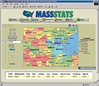
 | Caliper Corp.'s Maptitude includes nationwide street maps and census information, and it can locate data by address. It's priced at $395. |
' What is it? Mapping software lets you create digital maps, add data for presentation or analysis, and manipulate boundaries.
|
Want what you pay for
Edmund X. DeJesus of Norwood, Mass., writes about information technology.
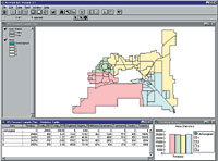
 | ESRI's ArcView GIS includes a districting extension, which automates the redistricting process. The suite is priced at $1,500. |
'Edmund X. DeJesus
| Company | Product | Platforms | Used for | Features | Price |
| Autodesk Inc. San Rafael, Calif. 415-507-5000 www.autodesk.com | AutoCAD Map 2000 | Win98, ME, NT, 2000 | Mapping | Database connectivity, raster support | $2,750 |
| Bentley Systems Inc. Exton, Pa. 610-458-5000 www.bentley.com | MicroStation GeoAddress | Win95, NT | Road systems | Routing, manual and automatic modes, integrates with MicroStation | $9,995 |
| MicroStation GeoParcel | Win95, NT | Parcel mapping, valuation | Land survey input, manual and automatic modes, integrates with MicroStation | $9,995 | |
| MicroStation GeoWater | Win95, NT | Water supply networks | Automatic plan generation, integrates with MicroStation | $9,995 | |
| Caliper Corp. Newton, Mass. 617-527-4700 www.caliper.com | Maptitude | Win9x, ME, NT, 2000 | Geographic and demographic data | Nationwide streets, census tracts, other types of data; can be located by address | $395 |
| Clark Labs Clark University Worcester, Mass. 508-793-7526 www.clarklabs.org/ 03prod/32frame.htm | Idrisi | Win9x, NT, 2000 | Raster-based imaging and analysis | Surface modeling, geostatistics | $1,000 |
| DeLorme Yarmouth, Maine 207-846-7000 www.delorme.com | 3-D TopoQuads | Win9x, NT | 3-D model of United States | USGS raster data, road and topographic vector data | $100 |
| Xmap Business | Win9x, ME, NT, 2000 | Street-level maps with phone directory listings | Address-to-address routing, demographic information | $100 | |
| Environmental Systems Research Institute Redlands, Calif. 909-793-2853 www.esri.com | ArcView GIS | NT, Win 2000 | Visualization and analysis | Database integration, Web publishing | $1,500 |
| Intergraph Corp. Huntsville, Ala. 256-730-7191 www.intergraph.com | GeoMedia Suite | NT, Win 2000 | Visualization and analysis | Database integration, projectmanagement | $1,500 up |
| Manifold Net Ltd. Carson City, Nev. 800-556-5919 www.manifold.net | Manifold System | Win9x, NT, 2000, XP | Mapping and analysis | Database connectivity,raster images, vector drawings, terrain surfaces | $245 |
| MapInfo Corp. Troy, N.Y. 518-285-6000 www.mapinfo.com | MapInfo Professional | Win9x, NT, 2000 | Mapping and analysis | Raster images, database connectivity | $1,495 |
| PCI Geomatics Arlington, Va. 703-351-3317 www.pcigeomatics.com | Geomatica Fundamentals | Win9x, NT, 2000; Unix | Mapping, analysis and visualization | File viewer, vector topological support, image processing | $2,500 |
| Softree Technical Systems Inc. West Vancouver, British Columbia 206-628-6454 www.softree.com | Terrain Tools | Win9x, NT | Mapping | Image handling, surveying and forestry versions | $179; freeware available |
| U.S. Geological Survey Reston, Va. 703-648-4000 mapping.usgs.gov/www/ products/software.html | GSMCAD | Win 3.1, Win95 | Mapping | Mapping application is one of many public-domain applications and software tools the Geological Survey maintains on its site | Free |
NEXT STORY: Commerce to get new technology chief


