A year ago, federal officials thought their IT systems were stout enough to cope with data demands brought on by the torrent of hurricanes expected to hit the Atlantic seaboard.But then came Charley, a category 3 hurricane with winds of more than 131 mph; Frances, another category 3 storm; and finally Ivan the terrible, a category 5 storm with 165 mph winds that caused more than $16 billion in damage along the Atlantic seaboard and threatened to plunge New Orleans below the sea'all in the first four months of 2004.The Homeland Security Department's Federal Emergency Management Agency and the Commerce Department's National Weather Service's IT systems were stretched thin trying to provide maps and data, and help with disaster relief, particularly because hurricane season didn't let up. The National Oceanic and Atmospheric Administration's Web site registered 565 million hits in September alone, a level equal to almost all the traffic for 2003.And this year's hurricane season, which began June 1, also promises to be a bad one, according to NOAA, which predicts a 70 percent chance of above-average hurricane activity.So, officials have fortified their applications with a relational database for geographic information systems information and Web portal for storm information.'One thing we learned last year is that when these types of storms threaten the mainland, people begin to pay very acute attention,' said Greg Hernandez, NOAA.gov editorial manager. He said the level and quality of storm information NWS provides is critical to the public's decision to evacuate or return home.FEMA's recent GIS upgrades are designed to improve the process for generating disaster maps.'These maps are used all the way from the president of the United States to the end user in the field,' FEMA CIO Barry West said.FEMA officials have shifted their GIS database from one using flat files to a relational system that uses an Oracle 10g database management system, according to Frank Oporto, program manager in the agency's GIS Solutions Section.With the Oracle system, 'we don't have to do data translation and can avoid some steps,' Oporto said. 'It's also a better way to do data retrieval.'The agency's Mapping and Analysis Center (MAC) uses the Oracle DBMS in conjunction with GIS suites from ESRI of Redlands, Calif., and MapInfo Corp. of Troy, N.Y.FEMA's spatial database is consistent with DHS' Geospatial Enterprise Architecture and uses the Oracle Spatial 10.1.4 tool to generate maps and analysis using both government and private-sector data.'We have more than 200 layers [of data in the GIS], at different levels and different scales,' Oporto said.The agency itself provides information layers, such as data about flood plans and flood insurance, telephone registration for disaster benefits, and satellite imagery. FEMA uses licensed data for layers such as ZIP code boundaries, congressional districts, business locations and street information.'We also take advantage of specific event-produced data,' Oporto added, citing the use of layers that describe the severity of storm damage from flooding.MAC data will form a key component of the department's Geospatial Service Center, which will provide geospatial data to DHS field operations staff and responders by Internet and wireless links starting this month, according to FEMA officials.The departmental center initially will offer a map service on the Web and geospatial data. Over the next year and a half, FEMA data will support the GSC's expansion to launch a community outreach portal and other functions.After hurricanes, FEMA workers will use the newly enhanced GIS to review maps helpful in response and recovery operations, such as those showing the status of electricity network repairs, emergency response teams, disaster zone boundaries and disaster benefit applicants.After last year's hurricanes, FEMA also rolled out several new services to disaster victims via the Web.West said that FEMA officials had pushed their online registration capability last year, in part because the third of four major hurricanes, Ivan, was headed straight for New Orleans. 'We would have had thousands needing registration and aid [if Ivan had hit the city],' West said. 'Our intent is to keep leveraging the Internet, especially in the ways we interact with other agencies, such as the Small Business Administration and the Treasury Department, to distribute benefits.'NOAA also has upgraded its IT response to this hurricane season.The agency plays a starring role in informing people on the mainland and on Caribbean islands such as Puerto Rico about storm winds, tides, tracks and landfall points.In the past, those who sought federal hurricane information 'would have to jump among Web sites' to get satellite images, National Hurricane Center updates and data from NOAA's fleet of sensor-laden seaborne bouys, NWS' Hernandez said.'Now it is all together,' Hernandez said, referring to the Storm Tracker Web site he built at .Storm Tracker merges three- and five-day hurricane tracking maps, infrared satellite images of storms, short- and long-range Doppler radar data, and wind speed charts, among other information.'I did it myself,' Hernandez said. 'I wanted to keep it simple and have a user interface for someone who is Web savvy enough not to get in trouble, as well as information for the more sophisticated users who will surf deeper for wind speed and wave height [data].'NOAA unveiled Storm Tracker at the beginning of this year's hurricane season and used it to present information about the first 2005 storm, Arlene.'I started working on it in September last year, but six weeks of [intense] hurricane activity left me weary,' Hernandez said. 'So I got back into it in late October and had it ready for this year.'Hernandez said he developed Storm Tracker to be friendly to users who have outdated browsers. 'I went back to [Version] 4.0 of [Microsoft] Explorer and Netscape so people would not have to download a plug-in,' he said.Storm Tracker's information is customized for each storm, and each version of it expires when the National Weather Service stops issuing advisories for the storm.NOAA maintains mirror sites to handle its peak traffic and also purchases bandwidth from Akamai Technologies Inc. of Cambridge, Mass., during especially busy periods.
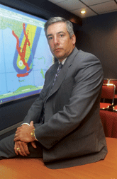
FEMA CIO Barry West
Rick Steele


