Sometimes the simple ideas have the greatest effect. For example, if you have legislation dealing with geographical features ' such as maritime boundaries, shorelines and fisheries ' why not display them on maps?That was the reasoning behind the launch in December 2006 of the Digital Coast Legislative Atlas.[IMGCAP(1)]Developed by the Coastal Services Center, an office in the National Oceanic and Atmospheric Administration, Digital Coast combines spatial tools with legislative data in a Web interface.The idea is to represent the spatial footprint of ocean and coastal laws. Using Digital Coast, resource managers can visualize the spatial relationships between legislation and other relevant marine boundaries to analyze gaps and overlaps in a region's regulatory framework. The atlas also contains the regions, districts and planning areas of federal management agencies with respect to ocean and coastal activities. This helps state and regional resource managers determine whom to contact in federal agencies for a particular area of interest.Hamilton Smillie, branch operations manger for Coastal Geospatial Services, said current laws affecting ocean and coastal management are primarily a collection of single-issue management laws and authorities that don't match up well with human activities and biological and physical systems.In addition, management responsibility is spread among a variety of federal, state and local agencies, often resulting in redundant efforts, inefficiency, confusion and lack of coordination.[IMGCAP(2)]'The atlas allows resource managers to search the inventory of federal and state laws, read summaries of those laws, and link directly to the supporting U.S. Code or state statutes. The search features can be refined by state, region, management issue or federal agency of interest,' Smillie said.The project began several years ago with an informal project called the Ocean Planning Information System. But Smillie said the pilot project was less than user-friendly and had to wait on certain technological and political advances.'We found that neither was technology there to do what we needed to do nor was the political climate ready for state coastal managers to work across regions,' Smillie said. 'A lot of that has changed now.'Digital Coast was built primarily using ESRI's suite of geographic information system tools. But the intended primary audience for the atlas is resource managers, most of whom have little or no experience with desktop GIS tools. So developing programming tools that could move the application to the Web was critical. Development of Google's Keyhole Markup Language for displaying geospatial data on the Web, along with tools for converting data from ESRI format to KML, were especially important.'If it weren't for standardized data formats and translators, I don't think we'd be where we are today,' Smillie said.Meanwhile, political changes were on the horizon. Most notably, the Commission on Ocean Policy, which was established under the Oceans Act of 2000, called in 2004 for fundamental changes to improve the uncoordinated management of U.S. oceans and coasts. These recommendations included changes at the national level, but they also recognized the need for regional collaboration.One of the unexpected challenges in creating Digital Coast was the vagueness of geospatial references in legislation.'It was an eye-opening experience for us,' said Cindy Fowler, GIS integration and development manager. 'As we started uncovering the laws, we realized pretty quickly that all of these things wouldn't hold up [against] the modern mapping standards.'For example, a boundary line on a paper map could represent a distance that is a mile or two wide, Fowler said.And some legislation might refer to the shoreline without more specific references. The exact coordinates involved in digital mapping often required more specificity than was legislated. 'You can hide a lot of sins on a paper map,' Fowler said. 'When you start going digital, that's when everything starts coming to light.'When the team found such incompatibility or vagueness, they tried to resolve the issue with the appropriate unit before mapping, whether it was the Justice or Transportation departments or one of the regional authorities. And such political efforts have their own challenges, Fowler said. 'It makes for some interesting things when a bunch of lawyers and a bunch of mapmakers get together in a room,' she said. 'Boy, talk about one's from Venus and one's from Mars.'When uncertainties could not be resolved, they were noted in the Digital Coast database.Digital Coast is already gaining plaudits.'At the last [Florida Fish and Wildlife Conservation Commission] meeting a couple of weeks ago, we needed to have a map that showed the Submerged Lands Act boundary, and it had a weird shape where it suddenly bulged out in one area in the upper Florida Keys,' said Henry Norris, program administrator at the Florida Fish and Wildlife Research Institute. 'They were doubting that that was what it really looked like. I went to the atlas and [pulled] it up. Yes, the SLA boundary did indeed have that strange boundary.''What's nice about this is it is one-stop shopping, and it's backed by NOAA, so it has some validity,' Norris said. 'There's no other place where I can find all the laws, [all the] marine-related legislation, in one spot.'The Coastal Services Center plans to rapidly expand Digital Coast. The next release, scheduled for fall 2008, will include federal laws for the entire United States, including Hawaii, Alaska, the Great Lakes, and Pacific and Caribbean islands, and state laws for California, Hawaii, Maine, Massachusetts and New Hampshire.'We intend to continue creating the state-level data until we've gone around the country and have done the highest-priority data for state workers,' Smillie said. 'Then we'll continue to update and maintain the databases and expand as new laws come on the books or the current laws change.'
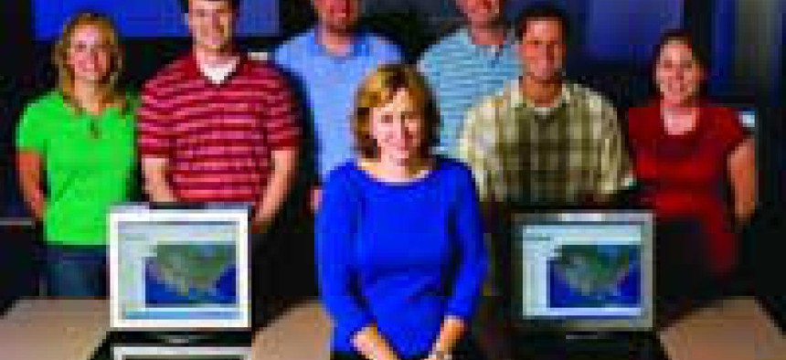
DETAIL-ORIENTED: Cindy Fowler says Digital Coast adds geographic details to coastal legislation. 'You can hide a lot of sins on a paper map.'
Brett Flashnick/WPN
SHORE THINGS: Cindy Fowler and the Digital Coast team used tools to convert to geospatial data.
Brett Flashnick/WPN
For the complete list of the 2007 GCN Award winners, click here
Stutter startRough maps


