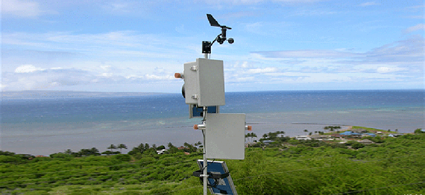
DIY remote imaging system, courtesy of USGS


Connecting state and local government leaders
A team of U.S. Geological Survey scientists offer detailed advice in building an automated, solar-powered imaging and environmental sensor system.
Agencies have been making a lot of use of remote monitoring systems, for everything from monitoring snowfall and other weather data to bridge monitoring and even tracking airborne drug smugglers.
One of the most active users of remote monitoring systems is the U.S. Geological Survey, which deploys monitoring systems for a variety of programs. So active, in fact, that a team of USGS scientists built their own solar-powered, automated imaging system, using inexpensive off-the-shelf parts.
In a paper published on USGS’ website, the team -- Rian Bogle, Miguel Velasco and John Vogel -- offer a detailed, illustrated account of putting together the system, which has been used for environmental monitoring in locations such as the South Pacific and Mojave Desert.
The system described is one type the team created, the authors write, and is intended to be “easily replicated, low-cost, highly robust, and is a stand-alone automated camera designed to be placed in remote locations, without wireless connectivity.”
There are four basic components to the system, the authors write: a data logger, imager (camera), sensors and power subsystem. The data logger provides the system’s main functionality, acting as clock, programmatic controller and environmental interface, with a programmable software stack at its core, the team writes.
They used a Campbell Scientific CR200-series data logger as the system’s controller and a Canon EOS Digital Rebel camera as its imager. The team notes that the camera supports a persistent power source and, no small consideration for remote work, a power switch that can be left on. It also allows for electronic image triggering. Images are stored on an 8G flash card in the camera, which the team said would typically be good for a few months’ worth of images.
Sensors for the system depend on how and where it’s going to be used. This system has been used, for instance, to measure wind speed and direction (with a Davis Instruments 7911 anemoeter), soil moisture (Campbell tipping buckets) and air temperature (Campbell temperature sensors). The system runs on the Campbell Scientific PakBus operating system, with a script written in CR-Basic, and it uses Campbell’s pc400 development software to communicate with the data logger.
For power, the team typically used a 10-watt solar panel and a 7-amp 12-volt battery, which delivered enough juice for the camera to take pictures as often as every 10 minutes during daylight hours.
For any other agencies thinking of building such a system of their own, the team’s paper goes into great detail, with pictures and diagrams, on how they assembled it, operated it and deployed it.
Agency research teams deploying remote monitoring systems could use this template to build their own, particularly if they don’t have experience constructing such devices. The idea was to take advantage of commercial products to build a system from “readily available, low-cost components, powered entirely by solar energy, highly flexible in scheduling and automation, and requires no remote communication, minimal maintenance and only occasional visitation for data retrieval,” the team writes.
“The ultimate goal of the design of this system is that it be easily replicated by others who may have minimal technical or electronic experience.”
NEXT STORY: Need help building mobile apps? GSA can help.


