LIDAR mapping projects explore the fourth dimension


Connecting state and local government leaders
Pioneers of light detection and ranging point out that it's not just 3D -- terrain changes over time, and rescanning an area can show its evolution.
Project managers appear to be in consensus about the lessons learned from the first generation of light detection and ranging (LIDAR) mapping, which uses the data gathered from bounced light to create detailed, 3D maps.
For one thing, it’s not just three-dimensional. The impacts of man and nature cause changes in topography, including underwater topography. So it's important to rescan periodically, to see how things have changed across the fourth dimension, time. What's more, since the hardware and software continues to improve, and since agencies have come to realize the value of the data, rescans are even more in demand.
"We started our collection in 2007, flying at 8,000 feet," said Charles Fritz, director of the International Water Institute, which runs the Red River Basin Decision Information Network. The RRBDIN is mapping chunks of North Dakota, Minnesota and central Canada. "Our spec was we wanted at least one ground point every 1.4 meters of landscape at plus or minus 15 centimeters. With the new technology we can easily get 10 or 11 points per square meter. Think of it as putting on a better and better pair of cheater glasses."
The U.S. Army Corps of Engineers currently is on its second LIDAR data-gathering effort covering the nation's shorelines, and has seen how improved technology has broadened the scope of the project.
Infrastructure inspections via LIDAR

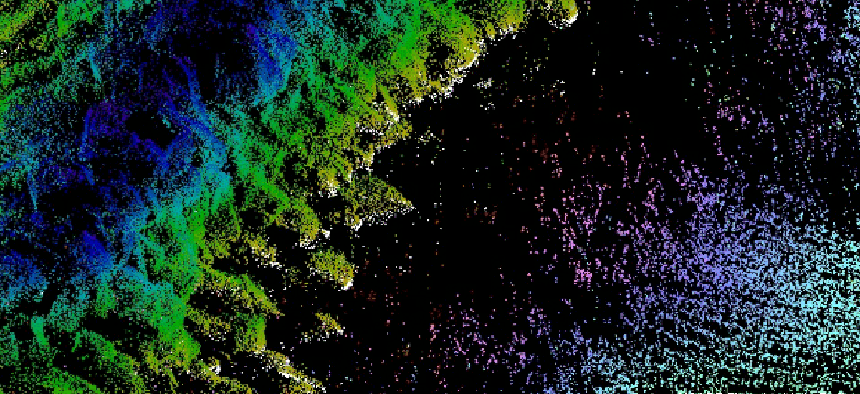
The Army Corps of Engineers manages over 1,000 coastal navigation structures, such as the Kaumalapau Harbor breakwater in Hawaii (pictured above).
General monitoring techniques include lidar or photogrammetric surveys, bathymetric sonar surveys, conventional ground surveys, walking inspections, and damage surveys that are more comprehensive than typical field inspections, according to the Corps' Costal and Hydraulics Laboratory. The data is compared to historical data and to standard design methods in order to improve designs.
Employing both topographic and bathymetric (working under water) LIDAR in aircraft, the Corp's National Coastal Mapping Program scans the shoreline — including Hawaii, Alaska and the Great Lakes — in a swath 500 meters inland and 1,000 meters offshore. At current funding levels, the team can cover the entire shoreline every five to six years.
Chris Macon, technical lead for program, said that the primary purpose of the program has been to track the movement of sand to ensure safe navigation of the country's waterways. "We're finding out how much sand there is, where it is, where is it moving to along the coast and how it is impacting federal navigation projects," Macon said.
The airborne bathymetric LIDAR delivers 25-30 centimeters of vertical accuracy, and its maximum penetration is roughly 50 meters in crystal-clear waters, he said.
Navigation issues are still the priority, but as LIDAR scanning and analysis has gotten more accurate and applications have proliferated, federal, state and local agencies are asking for more coverage inland.
"As our capabilities have grown, adding topographic LIDAR, adding true color imagery and adding hyperspectral imagery, people want more coverage inland," Macon said. In addition to navigation issues, he said, the data is being employed for invasive species mapping, impacts on wetlands and post-hurricane assessments.
Beyond collecting better data, LIDAR pioneers agree on the importance of educating and working closely with those who can make the best use of the LIDAR data.
"We spend a lot of time talking with our local stakeholders and developing relationships with people throughout the state, letting people know when flights are happening, who can gain from them," said John English, LIDAR data coordinator for Oregon's Department of Geology. "We travel throughout the state on a regular basis, giving presentations and talking about the technology. It's going out to local constituents in different places with different needs and concerns and addressing them directly."
Finally, implementers agree that right now the pressing need is for more applications that can make effective use of the data that has already been collected.
"The sensor technology to collect the data has reached a point where we have very dense data,” Macon said. "Some people can use the point data and go drive their own products and information from it, but a lot of people don't want to have to do all the analysis and digging into the data to get the information out. That's where we try to help evolve products and provide more information to the users."
PREVIOUS: When LIDAR came down to Earth, mapping projects took off
NEXT: LIDAR-equipped robots map a city’s interior.


