What's next: Urban mapping, down to the doorknob


Connecting state and local government leaders
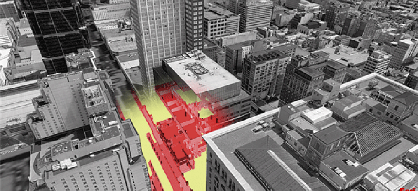
Using a robotic LIDAR platform, Philadelphia captured building interiors with CAD, 3D and video models of the structures and their contents, even furniture.
Fourth of four parts
Philadelphia has long been at the cutting edge of municipal use of geographic information systems. And a recent pilot project that employed LIDAR-collecting robots has convinced even the city's skeptical GIS director of the value of moving beyond 2D maps to the 3D models that LIDAR enables.
LIDAR, or light detection and ranging, uses laser sources to bounce light off of objects and record an image. In recent years, as the technology has improved and costs have dropped, agencies have used airborne LIDAR systems to revolutionize the mapping of flood plains, forests and coastlines, even below water. Now, Philadelphia is bringing the technology indoors.
In 2008, the city decided to use some available grant money to launch a project to scan its Center City area with LIDAR and combine it with existing oblique imagery data. Oblique imagery is aerial photography captured at an angle that shows the top and sides of objects.
"It was purely experimental," said GIS director James Querry. "We decided to apply it to a section of the downtown and a section of a sports complex area and see what happened. Up to that point I was not convinced that 3D modeling was a viable solution for anything, as it was so expensive to create any meaningful level of detail."
Two factors changed Querry's mind. First, "I found out that we could generate a model from data that we already collect for other things: oblique imagery."
The city had been generating aerial oblique imagery since about 2003 to have a record of changes in the city's urban infrastructure. The imagery was already in use in departments across the city for such things as zoning applications, asset management and emergency response.
Querry said aerial LIDAR data helps his staff generate digital elevation models that can support the correction of aerial imagery.
The second factor was the demonstrated value of collecting not just above-ground data from aircraft, but interior data — the insides of buildings and underground structures.
In 2010, the city hired PenBay Solutions, an Esri partner, to scan the insides of selected public buildings and the underground transportation infrastructure. A robotic 3D LIDAR platform was pushed through the halls, rooms, tunnels and other spaces at a human's walking pace, collecting more than 5,000 data points per square meter. The robot also took 360-degree geo-referenced images.
The result was a dataset that included both Computer-aided Design and 3D models, including video models, of the structures and their contents, such as stairways, doors and even furniture. "We're collecting everything from building façades to poles and trees," Querry said. "Even doorknobs."
City staff members have access to the files via the Web using Esri’s ArcGIS for Server as the geodatabase.
The potential demonstrated by the pilot, Querry says, was impressive. "For major buildings and underground spaces where people congregate, you have a fully geo-referenced and fully intelligent 3D model, showing doors, access ports, escalators, stairs, even down to a ladder that is actually an emergency access," he said.
"There are a lot of things you could use this fully intelligent 3D model for,” he said. “Public safety and emergency management are probably at the top of the list. If something happened in one of the subway areas and you're sending first responders in, those first responders have transponders, you can see where they are in the model and you can help guide them."
Querry said that despite the performance of the model, it may be just scratching the surface. "We're at the point where the technology has been tested and it is evolved a bit on the data collection side and the software side. I think we're at the point now where if we wanted to do [more] we could," he said. "It's totally function of resources."
NEXT STORY: 3 technologies from SXSW worth government time


