Serious game tests GIS, disaster response skills


Connecting state and local government leaders
A Rochester Institute of Technology team comes up with a GIS-based game involving toxic materials that can be adapted to other scenarios.
They may not be much at coming up with catchy names for software, but a team of students and faculty at the Rochester Institute of Technology have done a pretty impressive job of using geographic information systems to sharpen spatial-thinking skills of first responders.
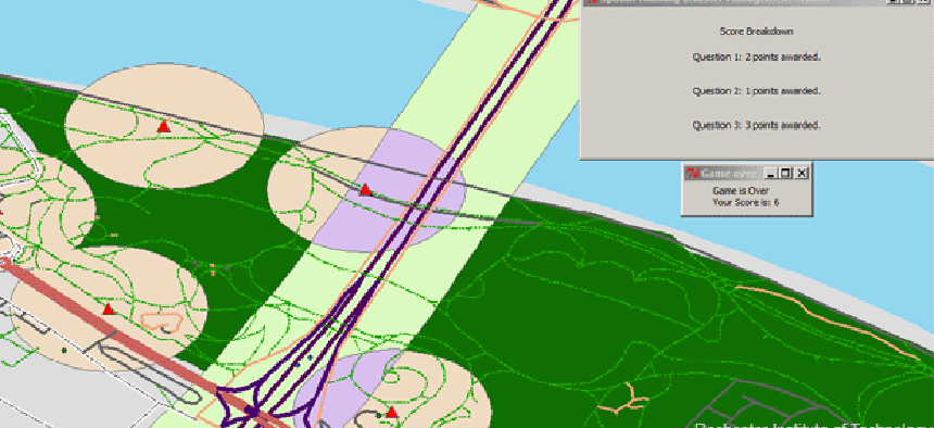
The “Serious Game for Measuring Disaster Response Spatial Thinking,” which runs on ESRI's ArcMAP, presents a scenario in which toxins have washed up on the bank of the Rhine River in Bonn, Germany, after a flood. The player is then given a series of questions for remediation, such as, "Which feature class would you like to buffer in relation to risk of population?"
Once the player chooses, the game repopulates with new information based on that choice. The operation is completed by Python scripts so that the player doesn’t actually have to know how to perform the operation using ArcGIS tools.
"We really wanted them to focus on looking at the map and reasoning about the relationships between the various entities," said Brian Tomaszewski, project leader and assistant professor in RIT’s Department of Information Sciences and Technologies. "You do need to have a basic understanding of the some of the functions, such as a buffer. But the plumbing behind the scenes is taken care of through Python programming. Then they can quickly see the results of their actions and continue making decisions."
At the end of the game scenario, the players receive a score reflecting their spatial thinking skills, as well as a discussion about what choices they might have better opted for and why. As a result, Tomaszewski said, the game not only can be used to demonstrate the potential effectiveness of GIS in disaster response, it can also train responders to select more appropriate responses in particular situations.
Currently, there is only a single disaster scenario for the game, but Tomaszewski said the game was designed in modular fashion to accommodate easy expansion. The questions sets, for example, are written in JavaScript Object Notation (JSON) format. And while first scenario uses data from OpenStreetMap, the game can employ data in any format that ArcMAP can bring in.
The Serious Game was the result of a 10-week class taught by Tomaszewski in the fall of 2012. "The students have very diverse backgrounds," he said. "The computer science students did a lot of the coding. Other students did the compilation of GIS data sets. Other students did documentation."
Tomaszewski said that, in addition to creating more disaster scenarios, he wants to port the game to the Web to make it accessible to more people. "For people learning about disaster management, being able to think spatially, to understand relationships between things — distance, scale and so forth — is important," he said. "It's a way of reasoning about the world that GIS can help enable."
NEXT STORY: 5 steps to making agile development work


