California PD tests the limits of cellphone tracking


Connecting state and local government leaders
Mountain View police recently tested an opt-in system from Polaris and found that it mostly works, though there are trade-offs.
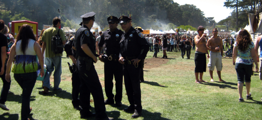
The Mountain View, Calif., Police Department put a new cellphone tracking application from Polaris Wireless through its paces recently, using it to monitor the location of its officers during a two-day concert in the Silicon Valley community.
“It worked,” said Lt. Chris Hsiung, the department’s special operations manager. “Fortunately, there were no emergency situations where we had to use it, but this was a nice piece of information to have.”
Cellphone tracking is not new. A number of companies, including Polaris, provide location information on cellular calls to 911 call centers, and mobile carriers use GPS data to deliver location-based services to customers. Police and fire departments and other emergency responders want to be able to locate personnel accurately in the field. The challenge is how to allow tracking across a broad range of service providers and devices without installation of a dedicated infrastructure and without violating privacy.
The Mountain View test was conducted to see if the Polaris application based on widely available commercially carrier services is good enough for public safety use.
The answer: Yes, but with limitations.
In a small, open-air environment such as a concert venue, where it was tested Oct. 5 and 6, “it has value,” said Bhavin Shah, vice president of marketing at Polaris. There is latency and limited accuracy, but it can provide a general view of the location of officers on foot in a small area, which can be helpful in a police command center.
What it cannot do is give tactical data for situational awareness for SWAT teams or firefighters inside a building. “We’re not there yet,” Shah said.
The next step for Polaris is to work with police departments to determine in what situations this kind of information can add value and how existing technology can be tweaked to tease out greater accuracy.
“This is still pre-beta,” Shah said. “The app is ready. We are experimenting with the commercial location offerings that are available.”
Polaris already has a tool called OmniLocate that provides accurate location data for 911 services and law enforcement surveillance, using radio frequency pattern matching. The company maps the RF pattern fingerprint of an area and matches the patterns being generated by cellphone transmission against its locational database to pinpoint a device’s position. But OmniLocate has to be integrated into a carrier’s network. This is fine for limited uses such as 911 service, but it could be difficult to scale for broad use.
“We wanted something that was cross-carrier because we weren’t sure what phones the officers would have,” Shah said.
Polaris built its Altus application as a front end to Locaid, a location-as-a-service provider already integrated into major U.S. mobile carrier systems for location-based services such as local merchant advertising. It has a standard Application Programming Interface that Polaris used for Altus, a command center application that lets a police department visualize the location of its officers using a geographic information system.
Altus addresses the privacy issue with an opt-in system for users. Officers agree to be tracked by texting an opt-in message. Cellphone data then goes to the Altus application hosted by Polaris, which obtains a position fix from Locaid that is displayed on the police department’s command center maps. Officers can stop tracking by texting an opt-out message.
What remains to be seen is if the system is accurate enough to be useful. Locaid uses GPS data, and “GPS has its own limitations,” Shah said. Indoors and in dense urban environments especially, it does not perform well. Most users of GPS-based navigation applications do not notice this because of the assist the applications get from GIS data and algorithms.
This assist is not available with Altus because no application is loaded onto the phone. But by not requiring any client software, the tool can work with any type of GPS-enabled device over any carrier using Locaid.
Mountain View became involved in the testing almost by accident.
“A traffic officer pulled over someone from Polaris,” which is headquartered in Mountain View, said Lt. Hsiung. The technology came up during a conversation and “it came to my attention. They are literally down the street from us.”
The department saw potential for the system and agreed to give it a test during a weekend concert attended by about 20,000 people a day.
“The nice thing about the Polaris tool is the opt-in feature,” Hsiung said. Most of the officers have department-issued cellphones, and “most were interested in doing this.”
About 70 officers were assigned to patrol the concert on foot. To keep the test simple, one phone was tracked in each team of five to 10 officers. The department went into the test without big expectations. “It’s still in the very beginning stages,” Hsiung said. “We’re in an educational phase. We don’t know what we don’t know yet. We have a few more ideas” for tests.
One idea is tracking patrol patterns and matching them against GIS data for high-crime or high-accident areas, to see if resources are being deployed where needed. Less-than-pinpoint accuracy and latency would not necessarily be a hindrance in this type of analysis. It also could be used as a workforce management tool during severe weather alerts, to ensure that emergency personnel are stationed where they are most likely to be needed in an emergency.
Shah said Polaris is working with a number of police departments to develop other use cases and scenarios for testing to see how useful the technology is in its current state.


