Rutgers' RTM Dx makes crime prediction affordable


Connecting state and local government leaders
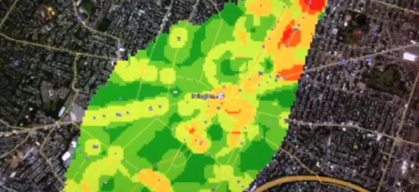
RTM Dx is a free tool developed by researchers at Rutgers University's School of Criminal Justice to help police predict where crimes are going to occur.
You can tell RTM Dx isn't the product of a commercial enterprise by the fact that it doesn't have a catchy name. In fact, the full name – Risk Terrain Modeling Diagnostics – barely hints at what the package does.
RTM Dx was developed by researchers at Rutgers University's School of Criminal Justice to help police predict where crimes are going to occur. It is being offered free of charge to law enforcement agencies and was being introduced at the annual Safety Datapalooza sponsored by the White House Office of Science and Technology Policy.
Why another crime analysis package? "The large police departments – Chicago, New York – have GIS, and they have skilled and trained analysts to use it," said Joel Caplan, assistant professor and one of the developers of RTM. "But there are a lot of smaller departments that have the skilled and trained analysts but don't have the proprietary GIS software."
RTM Dx is a self-contained program that allows analysts to enter geolocated crime data as well as location data for selected features in the community, such as schools and bars. Once the user specifies outcome variables, the utility then measures the spatial correlation between where the crimes have occurred and where they are in relation to different features of the environment. Those in law enforcement will use their own expert judgment to select what environmental factors, as well as what types of crimes, they want to track.
"There are a number of different factors that create unique settings that may be more or less attractive to criminals," Caplan said. People could be walking home from school and committing crimes along the path that they walk, Caplan said. "And the influences that bars impose on the nearby environment for crime are going to be different at say 11 a.m. on a Monday compared to 11 p.m. on Friday. Even though the features tend to be times stable, or static, the influences that they have on the attraction of illegal behavior are actually quite dynamic."
Under the hood, RTM Dx relies on open-source software to run its routines. Specifically, the utility uses R to do the statistical analyses and GDAL for geographic manipulations.
Already, the team at Rutgers is working with police departments in: Arlington, Texas; Chicago; Colorado Springs, Colo.; Glendale, Ariz.; Kansas City, Mo.; and Newark, N.J. Caplan, however, is quick to add that while the utility was developed for law enforcement, it can be used for other things as well.
In addition to the utility itself, Rutgers offers a six-month, self-guided webinar for training. The webinar, which costs $625, includes reference material, data and a never-expiring license for the professional version of RTM Dx. The only difference between the free and professional version, by the way, is that the former can't print GeoTiff maps, although data can be exported to other GIS programs for printing.

NEXT STORY: Zettaset adds encryption feature to Hadoop management platform


