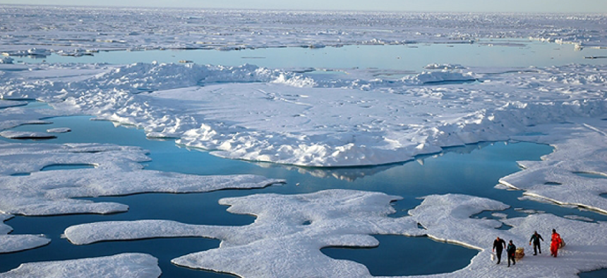
Agencies prep for arctic oil spills


Connecting state and local government leaders
In the Arctic Shield 2014 exercise, researchers will test technologies for oil-spill remediation, emergency response, satellite communications and mapping and visualization.
The ability to detect and manage oil spills in the Arctic is becoming more of an issue as oil and gas exploration, tourism and fishing are expected to increase in the area. In August, teams of researchers started on a month-long voyage to study how to deal with potential oil spills in the Arctic.
Dealing with Arctic oil spills presents unique challenges. Normally the National Oceanic and Atmospheric Administration or Coast Guard would survey the ocean for the oil’s precise location from the air to improve its model of the oil’s expected behavior. However, teams may be unable to get aircraft to the location, or flying in the area may be unsafe.
Additionally, a major cleanup would require a massive number of boats, airplanes, equipment and personnel. But infrastructure to transport and support those resources is lacking in the Arctic, which has scarce numbers of roads, airports, hotels and other critical items.
As an example, the BP oil spill in the Gulf of Mexico required 13,000 people, 520 vessels, 1.4 million feet of boom and a half million barrels of dispersants in the first three weeks after the incident, according to the Pew Charitable Trust. In total, the spill required 40,000 people, according to NOAA. If an oil spill occurs in the Beaufort Sea, north of Alaska, the nearest and largest community is Barrow, population 4,429.
Spotty communications in remote locations adds to the difficulty of coordinating efforts and understanding what is happening when time is of the essence.
The Arctic Shield 2014 expedition gave government, industry and university researchers the ability to study an oil spill under real world conditions. Today scientists have virtually no experience with Arctic oil spills – most research has been done in labs or in small scale trials.
NOAA partnered with the U.S. Coast Guard Research and Development Center for the testing, travelling aboard the USCG Cutter Healy, an icebreaker, to remote Arctic locations.
Once the Healy was far enough north, the Coast Guard simulated an oil spill using fluorescein dye, an inert tracer, to test oil spill detection and recovery technologies in ice conditions. The team also tested unmanned airborne and underwater vehicles and techniques to collect data on ocean conditions, such as temperature and currents in the areas where oil is mixing and spreading in the water column.
The Coast Guard and Marine Exchange of Alaska teamed to test the capabilities of existing electronic Maritime Safety Information infrastructure in the Arctic as part of Arctic Shield 2014. And the Navy tested its Mobile User Objective System (MUOS) next-generation narrowband military satellite communications system, which is designed to provide smartphone-like communications to mobile forces.
Other areas of research included boat operations, communications, navigational safety and engineering improvements for Coast Guard boats in a cold weather environment.
One of NOAA’s goals was testing the Arctic Environmental Response Management Application (ERMA), a stand-alone computer model for use in remote locations. ERMA is a web-based GIS tool that helps emergency responders and environmental resource managers in dealing with potentially harmful environmental incidents.
Arctic ERMA is an Arctic-specific version of the mapping tool that integrates data streams from the Arctic Shield technologies to provide a centralized visual representation, according to Zachary Winters-Staszak, a geographic information systems specialist with NOAA’s Response and Restoration office.
Normally an online tool, scientists will be using an independent version of ERMA, known as Stand-alone ERMA, for gathering scientific data during the voyage, according to NOAA’s Office of Response and Restoration. Radio tower and satellite connectivity, needed for Internet access, is extremely limited in the Arctic. Above the 77th parallel, there are few radio towers, and satellites often drop calls and can only support basic text email, according to a blog post from NOAA’s Office of Response and Restoration.
During Arctic Shield, NOAA tested the feasibility of using unmanned, remote-controlled aircraft to collect and report information back to responders on the ship, then pulling this information into Arctic ERMA, which displays the data.
In addition to NOAA and the USCG, there were 13 other agencies and universities participating in Arctic Shield 2014, including US NORTHCOM, US Space and Naval Warfare Systems Command, and the U.S. Army Corps of Engineers Cold Region Research and Engineering Laboratory.
ERMA is available at the NOAA ERMA website and additional information on how to use the tool is at NOAA.


