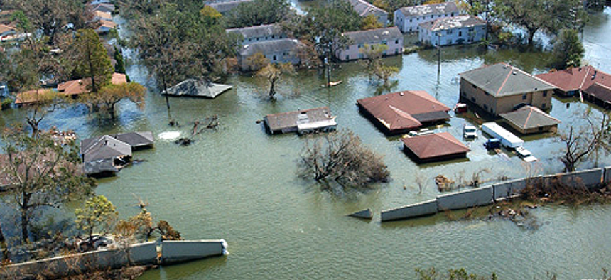
FEMA opened flood risk tools to property owners


Connecting state and local government leaders
The Federal Emergency Management Agency opened up high-quality flood risk data to property owners, improving public awareness and promoting risk mitigation.
The Federal Emergency Management Agency has been creating flood maps for 40 years to help identify community flood risks, inform local flood-plain management efforts and support the Federal Flood Insurance Program managed by FEMA. But however valuable the programs were, they weren’t living up to their potential, said Paul Huang, data dissemination branch chief.
Project at a glance
Project: Risk Mapping, Assessment and Planning (Risk MAP)
Office: Federal Emergency Management Agency
Technology used: A variety of geographic information systems, scanning, workflow management and content delivery solutions to leverage existing tools and infrastructure
Time To Implementation: Began in fiscal 2012 and continuing
Before: Limited access to and use of Risk MAP mapping and geographic information analysis tools.
After: Online access to Risk MAP data and products for better planning and risk mitigation by communities, along with reduced costs for FEMA.
“We wanted to do more than just provide data,” Huang said. “Why not leverage these regulatory programs and unify this?”
The result was the Risk Mapping, Assessment and Planning (Risk MAP) program, which delivers an array of data and services to help property owners, developers and communities plan for and manage flood hazards. In fiscal 2012 the program’s goals of delivering high-quality data, improving public awareness and promoting risk mitigation was hampered by a 30 percent cut in its budget.
Faced with these cuts, FEMA partnered with IBM, using technology to cut spending and streamline the program. The partners took a holistic view of technology, people and processes and developed an “innovation roadmap” for enhancing IT systems and infrastructure. The roadmap identified IT projects that could lower operational costs while improving service to customers, leveraging existing tools where possible to improve performance and minimizing investment.
In cutting operational costs, FEMA put everything on the table that might improve the Risk MAP project, even challenges that before had been considered too ambitious, such as digitizing millions of document in its paper-based Risk MAP Engineering Library.
Following the roadmap, FEMA sought ways to reduce software and hardware footprints through upgrades and consolidation. For its geographic information system (GIS) enhancements, the Risk MAP team migrated from the Esri ArcIMS product to ArcGIS for some applications and upgraded other existing ArcGIS applications. By using Microsoft’s Bing Enterprise License Agreement, they were also able to incorporate a Bing Map interface that significantly improved users’ experience. The site’s map search was also improved by replacing the ArcIMS geocoder with the Bing Geocoding Service used through the ArcGIS server JavaScript APIs.
Additionally, an automated online system has been created for those who want to change or amend data in flood plain maps by taking advantage of FEMA’s investment in its Mapping Information Platform. The platform was extended, creating new web pages for Online Letter of Map Change and making the feature accessible by the public. The Online LOMC system is a Java 2 Platform, Enterprise Edition, web application running on WebSphere and using DB2 for backend storage.
A Digital Case File system now uses new workflow tools and higher resolution scanning so that documents can be scanned once and used with the existing case management and document storage system rather than passing paper documents between steps. This has reduced storage requirements and cut the frequency of courier deliveries by 40 percent.
Distribution of the DHS’s Hazards US (HAZUS) GIS analysis tool used to assess flood risk and impact was shifted from DVD to online downloads using the Akamai Content Delivery Network, increasing overall HAZUS orders by 600 percent while reducing the demand for DVDs by 70 percent.
In addition, security has been improved through vulnerability scanning and patch management. A total of 699 critical or high-impact vulnerabilities were identified in Mapping Service Center production systems in 2012. Since then, Risk MAP has applied more than 43,000 server patches and migrated to supported versions of operating systems. MSC production scans now show zero critical or high-vulnerability findings.
“These are products that provide better customer service,” Huang said. “That’s the first step in driving better policy and risk mitigation it he future.”
NEXT STORY: Google launches YouTube for Government


