After 25 years, Census TIGER data still in demand


Connecting state and local government leaders
Developed for the 1990 population count, the Census Bureau’s TIGER data sets are still in demand as geospatial base data for new government and commercial mapping programs and applications.
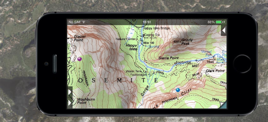
The U.S. Geological Survey plans to use TIGER (Topologically Integrated Geographic Encoding and Referencing) data sets from the Census Bureau next year as the primary source of road mapping data for its National Map Viewer and Topo digital mapping applications, the two agencies announced.
The Map Viewer is a web portal that enables downloading of digital data for creating new mapping products and services, while Topo supports frequent updating and fast public distribution, according to the USGS. Users can zoom in and out to examine specific features or see a broader area and print the maps in their entirety.
“The USGS is pleased to use the TIGER database as a base layer of The National Map and US Topo quadrangles,” said Julia Fields, deputy director of the USGS National Geospatial Program. “TIGER provides The National Map with an accurate, public domain database that meets the needs of our user community.”
The announcement of the USGS-Census data sharing project was made as the Census Bureau marks the 25th anniversary of the creation of TIGER data sets and services first created to help manage the 1990 census.
TIGER was the first nationwide digital map of roads, boundaries and waterways, according to the Census Bureau. Since then, its impact has extended beyond its original purpose by offering the government and public common electronic map data that runs today’s geographic information system technologies.
“TIGER is one example of how innovation in the government has spurred innovation and positive economic results in the private sector,” said Commerce Security Penny Pritzker, who noted that “TIGER helped grow an entire industry – the GIS industry – by providing popular mapping products integral to the everyday lives of Americans.”
Census Bureau Director John H. Thompson, who said the Bureau had a history of innovation, put TIGER on a level with the first mainframe computers as a historic achievement.
“From the Hollerith tabulating machine to the use of UNIVAC I, one of the first computers, and the development of TIGER, these achievements have provided significant technological advancement and improved our ability to deliver timely, reliable statistics,” he said.
TIGER came into existence with no backup plan or room for failure,” added Tim Trainor, who worked on the project 25 years ago as a cartographer and is now chief of the Census Bureau’s Geography Division.
Today, TIGER is a digital map database of geographic features including roads, railroads, rivers, and legal and statistical geographic boundaries require to support the Census Bureau’s data collection and dissemination programs.
In addition to creating TIGER, Census was one of the first agencies to create a public website and make its mapping services available online and on mobile devices. Today state and local governments can use TIGER datasets to create their own GIS systems with publicly available extracts of the TIGER database.
The new partnership with the USGS and the Census Bureau will return consistent and high-quality geographic data back to local communities, the agencies noted. “Our partnership represents good government by coordinating resources, eliminating procurement costs and developing improved data that are freely available to American citizens and businesses,” said USGS’s Fields.
Despites its longevity, TIGER data sets look to stay in high demand, especially with the 2020 decennial census. The Census Bureau is looking to update the TIGER database in preparation for the census.
In doing so, it will add the latest address, aerial and spatial data from other federal agencies, as well as state, local and tribal governments, according to a recent Government Accountability Office report on preparations for 2020.
NEXT STORY: 4 habits of highly effective open data portals


