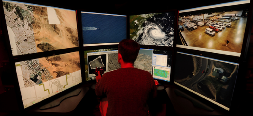
NGA on campaign to expand Map of the World


Connecting state and local government leaders
The National Geospatial-Intelligence Agency awarded 10 contracts this year in a $1.1 billion drive to expand its geospatial resources and build a one-stop shop for data and apps for the military and intelligence communities.
The National Geospatial-Intelligence Agency (NGA) awarded 10 contracts so far this year in a $1.1 billion drive to expand its geospatial intelligence programs, the agency said, as well as to supply ever more data to its Map of the World project.
Large and small contracts ranged from a $295 million award to BAE Systems to assist in the collection of geospatial data and network connectivity to a $2 million contract with Atlanta-based MapLarge Inc., for a high-performance, search and visualization engine that can render high-resolution datasets.
The awards, together with an effort to focus on new situational awareness technologies, are part of NGA’s effort to assemble a one-stop repository for geospatial data and apps for the military and intelligence communities, according to NGA officials.
In May, former NGA director Letitia Long said the agency was transitioning from being a provider of static products into, “a resource for dynamic GEOINT content, analysis and services.” Part of that work includes delivering the next phase of intelligence: immersion.
“By immersion, I mean living, interacting and experimenting with the data in a multimedia, multisensory experience with GEOINT as its core,” Long said.
The centerpiece of the immersion program is NGA’s Map of the World. While NGA doesn’t discuss specifically what data is available in its Map of the World, it is known to include extensive data on roadways, terrain, weather, building and even demographics in countries around the globe.
“Think air, sea and land,” said Col. Michael Senn, director of NGA’s content management office. “We have maritime data, we have aeronautical data, we have topographic data. We also have imagery, and we are also beginning to include some analytic products.”
The Map of the World is really a data portal rather than an end-user’s mapping application, designed to expose content, said Senn. “It is designed to be a self-assisted platform where users can create their own products.”
As with other big data projects, many of the data sets currently reside elsewhere, with other federal agencies and in some cases with private data providers. “It’s not like we hold it all in one place, although ideally to analyze the data better in the future we would consolidate the store somewhat,” Senn said.
In addition to providing one place to access data, the NGA also exercises quality control. “We vet the content, we make sure it’s appropriate and we make sure that the folks who hold the content hold to certain standards,” Senn said.
Now Senn’s team is looking to expand the database. “We put up the original Map of the World with data we thought would be most useful to the customer – DOD, the intelligence community, first responders and policymakers,” Senn said.
“Now what we are doing is taking customer feedback and working to assemble new data sets for Map of the World.”
One of the those customers is the Army, whose Situational Awareness Geospatially Enabled (SAGE) project aims to give its deployed personnel an advance look at unfamiliar territory using data sets and imagery collected from a wide array of sources.
“If you are new in a country, SAGE provides you a set of products that help you understand the environment,” said Dhiren Khona, principal investigator at the Army Geospatial Center’s Geospatial Research Laboratory. “It helps you understand where the slopes are, what the elevation is, and it helps you understand the mobility of your vehicle based on your vehicle’s height.”
The tools in SAGE even allow personnel to perform line-of-sight calculations both on-road and off-road. “Using line-of-sight calculations, you can determine where your vehicle may be exposed,” said Khona.
SAGE tools are implemented as a toolbox in Esri ArcGIS, the standard application for geospatial analysis in the Army. “We’ve developed these tools within Esri’s framework,” said Khona. “We wanted to keep the user interface simple, and the users are already familiar with the UI.”
SAGE is a part of the Distributed Common Ground System - Army (DCGS-A), the Army’s common system for intelligence gathering, analysis and sharing. It creates a consistent, Army-wide baseline for data ingestion and processing, as well as standardized and useable terrain analysis output for leaders, allowing more time for actual analysis.
According to Khona, SAGE is used both by geospatial engineers and by in-field analysts. It does, however, require a laptop computer. No interface has yet been developed for smartphones or other mobile devices.
As for what data SAGE analyzes, Khona would say only that the tools access the NGA’s Map of the World.
SAGE has been in development for four years. “Last year, we started interacting with units,” said Khona, adding that the tools were used in both combat and non-combat scenarios.” According to Khona, SAGE’s most recent use has been in Liberia, by teams responding to the Ebola crisis.
Khona said the reception of SAGE by field personnel has been positive, and the Army plans to expand its deployment. “We know that these tools can be used for other purposes as well,” said Khona. “I think our focus over the next four years will be to expand to other market areas of the government.”
Khona is also looking forward to evolving SAGE into a client-server application as tactical networks become more widely deployed. “Because bandwidth can be an issue in the field, the tools themselves work on the desktop, and whenever possible the desktop is provisioned with the necessary data,” he said.
“We believe that in the future we can move into a server-based environment.”
Editor's note: This article was changed Nov. 21 to correct the name of the Geospatial Research Laboratory.
NEXT STORY: USDA seeks database to maintain ‘organic seal’


