Not just for analysis, visualizations support transparency


Connecting state and local government leaders
When oil from the Deepwater Horizon gushed into the water faster than agencies could report on it, an online mapping tool increased data access for responders and the public.
When BP’s Deepwater Horizon rig ruptured in the Gulf of Mexico in 2010, oil gushed into the water faster than agencies could respond. And the problem wasn’t just stopping the leak, it was informing the public about extent of the damage and progress on fixing it.
“The public imaging of this really wasn’t a home run for the Coast Guard at day one,” Adm. Paul Zukunft, Commandant of the U.S. Coast Guard, admitted in a recent keynote address at the Center for Strategic and International Studies.
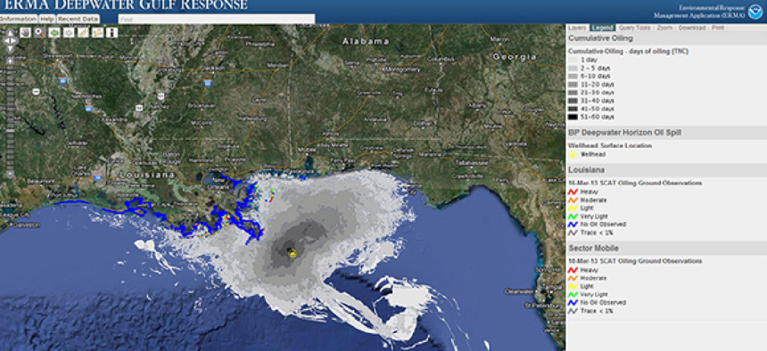
So the Coast Guard worked with the National Oceanic and Atmospheric Adminstration to develop the Emergency Response Management Application (ERMA), an online mapping tool that integrates both static and real-time data in an easy-to-use format for environmental responders and decision makers.
By putting the data “out on the Internet,” Zukunft said, “people could navigate through it and not wait for the next CNN news cast” to find out what was happening with the oil spill.
Before long, the joint mapping application exploded. “[W]ithin 12 hours we had 200,000 hits…The next day it was two-and-a-half million. And then the public trust level went up as transparency of information went up as well,” he said.
The application was subsequently adapted for oil Alaskan oil spills in 2012.
"Arctic ERMA builds on the lessons we learned on usability, data management and data visualization from the Deepwater Horizon/BP disaster," said Amy Merten, then with NOAA’s Office of Response and Restoration.
Beyond visualization of oil spills, NOAA’s Data Integration, Visualization, Exploration and Reporting tool, or DIVER, manages and integrates data from the myriad sources that collected information during the five years following the Deepwater Horizon spill.
“NOAA pledged from the start of the Deepwater event to be as transparent as possible with the data collected,” said NOAA Administrator Kathryn D. Sullivan. “The DIVER data warehouse approach builds upon that original pledge and is another significant step in making NOAA’s environmental data available for the research community, resource managers and the general public.”

NEXT STORY: Beltway bots: Virginia to test self-driving cars


