Forest Service creates gallery of maps and apps


Connecting state and local government leaders
The Engagement Portfolio opens up the Forestry Inventory and Analysis database, a collection of nearly a century’s worth of detailed information on the nation's forest ecosystems.
The U.S. Forest Service has opened data on more than 800 million acres of forest and woodlands with the Engagement Portfolio, a platform featuring interactive maps, analysis tools and applications.
The Forest Service partnered with Esri, a geographic information systems solutions provider, to develop the platform, which offers access to almost a century’s worth of forestry data from the Forestry Inventory and Analysis program, or the FIA.
The data collected by the Forest Service includes field inventories of forest land, a census of the forest products industry and a survey of forest land owners. The available datasets include more than 355,000 plots on public and private land across nine time zones, contributing to an FIA database of more than 19 million trees.
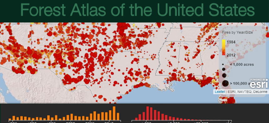
The Engagement Portfolio offers maps and visualizations that help the public explore and analyze information. For example, the Forest Atlas of the United States answers common questions, allowing users to browse tree and forest categories and analyze the relationships between field and satellite data, according to the Forest Service’s presentation at Esri’s FedGIS Conference.
The portfolio also includes a customizable EVALIDator tool, which allows more-technical users to view detailed summaries of data, produce population estimates and calculate sampling errors. The Forest Service is working to release an application program interface for the tool to facilitate its continued development.
Additional tools created for raw FIA data include a map displaying wood supply and processing data to illustrate interstate wood movement, a look at forest carbon stock reporting and a map exploring the dynamic of forest fires across certain landscapes incorporating nationwide data from federal, state and academic partners.
The FIA data is accessible to resources like ArcGIS Online and Geoplatform.gov. The range of users includes open communities, developers, scientists, resource professionals, educators, the media, decision makers and the general public.
For Forest Service managers, the new platform provides a current view of the agency’s entire inventory and all the plots being monitored as data is collected and moved to the public database, according to the USDA.
With the portfolio, Esri and the Forest Service aim to provide the tools that help forest managers and companies that rely on forest products to strategically plan, educate the public on the forest’s role in sustainability and assist with climate change response solutions.
"We're excited to make our agency's authoritative data more widely available, facilitating conservation actions and investments by the forest products industry, state agencies, academia, consultants, and the public alike," said USDA Forest Service’s Carlos Rodriguez-Franco, acting deputy chief of research and development.

NEXT STORY: How Small Communities Can Use Gigabit Fiber Expansion to Stand Out


