Crowdsourced images create DIY Street View

Mapillary applies artificial intelligence to crowdsourced street-level photos to create intelligent, navigable imagery of communities around the globe.
While cruising through photos from around the world on Flickr, Jan Erik Solem, a former mathematics professor from Sweden, wondered if all those pictures could be stitched together into a navigable photo map.
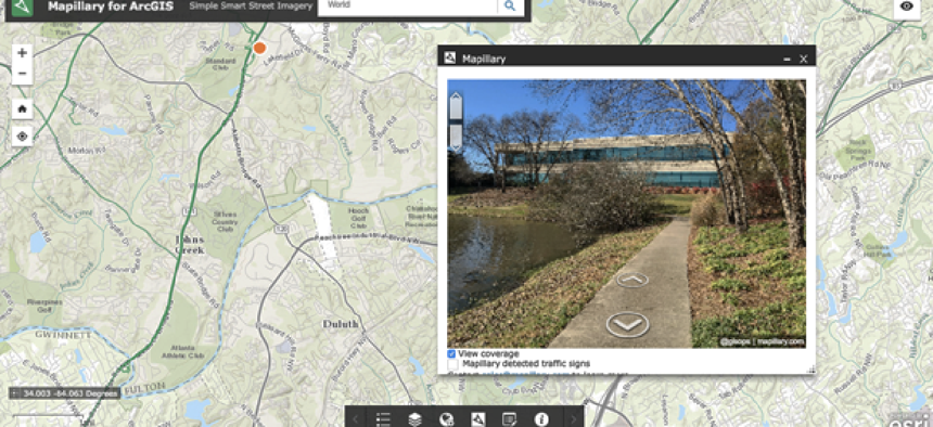
The result is Mapillary, a company that applies artificial intelligence to crowdsourced street-level photos to create intelligent, navigable imagery of communities around the globe. Users take photos using the Mapillary app, then load them into the company’s database where they will be connected with others’ pictures and combined into a street-level photo view.
Mapillary provides apps for iOS, Android and Windows Phone, together with tools for using action cameras like GoPro and Garmin Virb. It also provides a set of application programming interfaces so that others can use the photos and the data for their own applications. The company offers commercial solutions as well, including private repositories, that give an organization access to the full Mapillary service in a closed environment.
The company’s genesis was motivated more by Solem’s fascination with photographs and maps than by any desire for a geospatial application, said Janine Yoong, Mapillary’s business development director. However, Mapillary has turned out to be much more than that. Two capabilities, in fact, make it particularly well suited for public-sector applications.
First, it’s an open, hybrid environment that can save agencies money by combining freely available crowdsourced pictures with high-res professional imagery and even LIDAR scans to generate integrated visual environments of a community, a facility or a tourist attraction, for example. The only requirement of the imagery, Yoong said, is that it have GPS coordinates.
The accuracy of the geospatial data will, of course, depend on the source of the imagery. With an iPhone, Yoong said, the accuracy will “wander anywhere from 2 meters to 30 meters, if you are in an urban canyon area.” Those organizations that use iPhone imagery, she said, are usually more interested getting fresh pictures posted than in accurate location data. And organizations that use professional imagery can use Mapillary for measuring the heights of buildings, for example.
“The imagery is, indeed, mixed,” Yoong said. “For us, that is a feature -- that you can actually navigate within high-quality panoramic photos by professionals and then navigate over to a corner of the town taken by somebody with a micro cam on his bike.”
The other capability that makes Mapillary attractive to government agencies is its ability to recognize features in the collected imagery. The first such tool offered by Mapillary is a street sign detection tool.
“You could have someone … drive around the county for a few hours, capture the arterial roads, come back to the office in the afternoon and upload the images” and have a [version of Google’s] Street View, Yoong said. “And in another few hours, what you’ll be able see on the map is the location of all the traffic signs,” she said. “Not only that, what we can then do is tell you the lat-longs of all of those traffic signs.”
According to Yoong, the system is also set up to accept community feedback. A community member might, for example, report that a sign was missed or mislabeled. Because Mapillary has editing tools, “we have hundreds of thousands of edits from our community to help make our traffic sign detectors better,” she said.
Mapillary doesn’t figure to stop at detecting traffic signs. The company recently opened a research lab in Graz, Austria, to expand its detection capabilities. “We’re investing in more deep-learning efforts so that we can recognize more objects," Yoong said. "Things like manholes, street lights, fire hydrants, all the way to road conditions, guardrails, sidewalk cracks.”
According to Yoong, the company worked with residents of Washington D.C. in a Department of Transportation effort to gather photos from commuters and cyclists to report on road hazards.
While Mapillary’s current capabilities could help agencies perform infrastructure inventories, the additional intelligence would allow a public works department to spot infrastructure in need of maintenance or repair.
The key takeaway for government agencies, Yoong said, is that they may be able to crowdsource the pictures, rather than commission an expensive new collection of imagery. If the agency opts to use crowdsourced data they can build “a do-it-yourself Street View,” she said.
Editor's note: This article was changed July 5 to clarify the company's work in the Washington, D.C., project and to include an image that was more representative of Mapillary's use in government.


