FEMA keeps it simple with disaster app


Connecting state and local government leaders
Recent upgrades include weather alerts and reminders that keep users engaged.
In the Apple and Google Play app stores, it's easy to find the right Federal Emergency Management Agency app -- the agency has only one. And Tina Adinolfi, the chief and senior program manager of disaster management for FEMA, said there’s a reason for that.
“This is the only FEMA app, and we do intend to keep it that way,” Adinolfi told GCN. “It’s such an important tool for citizens that we never want anyone to get confused by what they’re downloading.”
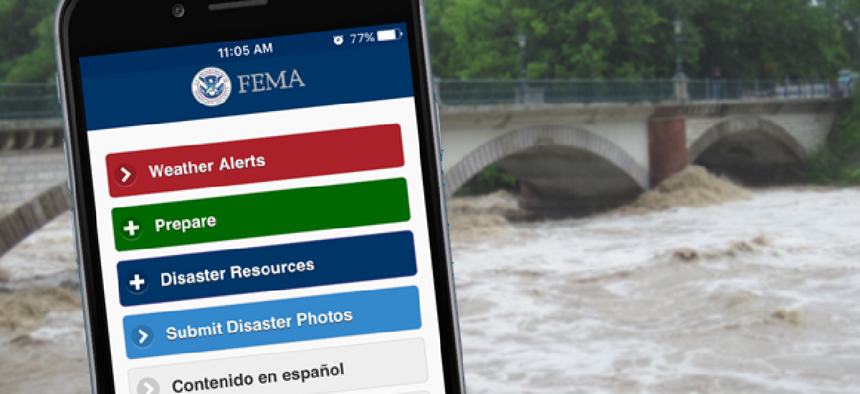
FEMA’s mobile app, which was originally released in 2012, offers tools and tips for users to keep safe before, during and after disasters. Its newest features include Weather Alerts, which allow users to select and receive National Weather Service alerts for up to five U.S. locations.
The goal is to get people to “not just to install the app and use it once,” but rather to provide relevant information that encourages them to regularly use the tool, said Craig Douglas, program manager at the Ambit Group, which worked with FEMA to develop the app. Features such as the NWS alerts get people “back to the app so they can take advantage of the latest information.”
Not all the new features require connectivity. In preparing for a disaster, people can use the app’s GPS maps to designate and store a post-disaster meeting place in the event families get separated. If there’s no internet or cell service available after a disaster, information on the meeting places is still available.
Other information available offline includes how to create an emergency kit, where to find a shelter and how to apply for disaster assistance as well as simple as reminders to practice a fire escape plan and to change the batteries on smoke detectors.
To take advantage of now-common smartphone features, the app allows users to take GPS-tagged photos of damage and makes that information viewable on a public map. This came in handy during floods in Colorado last year.
“First responders in the area found it to be a very valuable tool,” Adinolfi said. “Citizens took photos of washed out roads and little towns that got isolated as a result of the floods, and first responders were able to look at those photos and make plans on getting to and evacuating certain areas.”
FEMA and the Ambit Group are still planning updates for the app to make it easier for users, while at the same time keeping things simple.
“Right now we’re in the process of a redesign to make things more interactive, but the underlying goal is to keep the app simple,” Douglas said. “It’s not intended to be very flashy; its intent it to get information to users in a very easy and simple fashion.”


