Faster and more accurate flood prediction

StormSense, a new flood forecasting project, will give emergency managers in coastal towns flood predictions so accurate that residents can be notified if they need to move their car one street over.
Low-lying coastal areas are especially vulnerable to chronic, nuisance flooding from storm surges, rain and tides. Although the National Weather Service alerts city managers and residents of impending floods from major storms, those predictions could be better, according to Virginia researchers.
StormSense, a new flood forecasting project, was designed to give emergency managers in coastal towns flood predictions so accurate (every 5 square meters) that residents can be notified if they need to move their car even one street away.
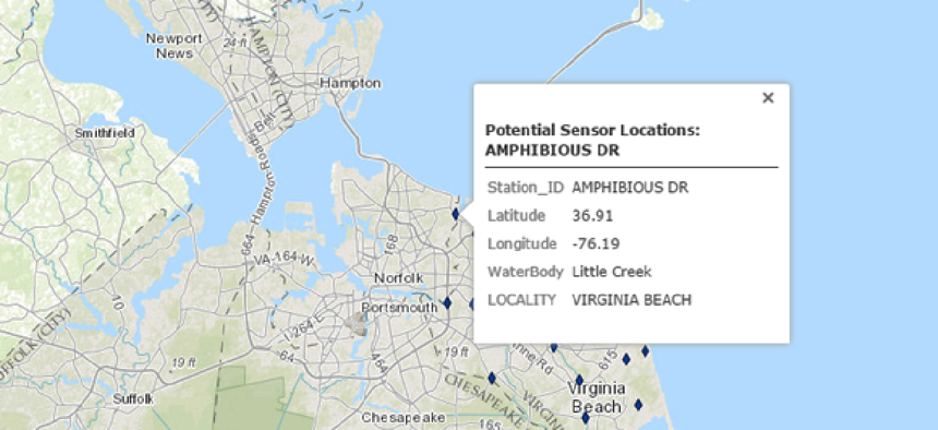
The project, being tested in the Hampton Roads area of Virginia, uses street-level hydrodynamic modeling to determine the types of flooding as well as the high-risk areas, explained Derek Loftis, from the Virginia Institute of Marine Science, who created StormSense and is heading up the project.
Those models, combined with crowdsourced data collected after floods and the implementation of a new, more accurate ultrasonic sensor system, lets users continually visualize flooding from storm surges, rain and tides up to 36 hours in advance of events, giving local governments time to prepare for possible flood situations.
The resulting data grid is overlaid with a base map of city data. This helps local governments give citizens timely alerts to possible property damage from nuisance flooding. It is a much more accurate decision-making tool than what coastal cities get from the National Oceanic and Atmospheric Administration. According to Tammie Organski, the City of Newport News' GIS manager who is working with Loftis on the project in her area, NOAA uses upstream gauges generally placed away from densely populated areas.
Additionally, Organski noted that flooding in Hampton Roads is often caused by rain rushing downstream while the tide is coming in, creating a unique situation not typically addressed by current flood models.
StormSense uses Internet of Things-enabled water-level sensors to improve flood modeling validations, the data from which has the potential to improve future forecast simulations. After floods, residents armed with the Sea Level Rise mobile app collect measurements on the extent of the nuisance flooding and feed that information back to the researchers, who use it to validate their inundation models.
With more accurate and timely data, “immediate decisions can be made to close roads or alert citizens to evacuations -- or even simple things like alerting citizens that they have to move their vehicles,” Organski said.
And even though Hampton Roads authorities have not worked out yet how to centralize the data from the IoT sensors so it is accessible to researchers, emergency managers and local residents, Organski said it is something most local agencies should be able to handle.
“We’re not talking about a huge volume of data," she said. "The readings are pretty simple data streams that say what the depth is at any given time. The model can be run on just a good heavy-duty workstation.”
So far, StormSense has not worked with the naval base in the area; Loftis said officials there probably have their own flood predictors. But Organski said she can see the weather information services wanting access to StormSense. “It’s pretty sophisticated and definitely more than what we’ve had.”
Loftis also said he hopes to expand the project nationally and internationally, adding that StormSense can be implemented on any coastal area. First, though, he wants to get it up and running in Hampton Roads. Although it is still in the testing phase, Loftis expects it to be delivering real-time data later this year.


