Tool would put Pittsburgh’s permits on the map


Connecting state and local government leaders
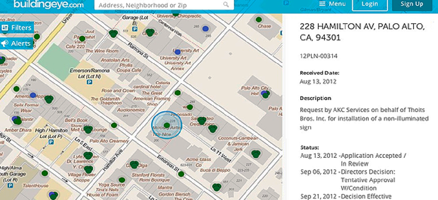
Working with Buildingeye, the city plans to create an interactive map showing the locations and details of recent permits, violations and inspections.
A Pittsburgh City Council committee voted unanimously to fund a new tool that will provide a map-based visualization of permits, licenses and inspections in the city.
Maura Kennedy, director of the Department of Permits, Licenses and Inspections in Pittsburgh and the project's lead, said the tool lets users view and search a detailed map that shows data on building and zoning in every neighborhood citywide, providing more transparency to residents and developers about how the city operates.
After issuing a request for proposals several months ago, city officials decided to work with San Francisco-based Buildingeye to construct the platform. The civic app developer has worked with a number of other localities on similar projects, including San Francisco; Palo Alto, Calif.; and Adams County, Colo.
Much of the data that will be on Pittsburgh's map was already available on the city’s website, Kennedy said, but it was not easily accessible or digestible. Currently, the data is in separate Excel files on different web pages, and information on licenses can’t be found anywhere online, she added. The goal is to make it easier for the general public to find and use data by putting all the information in one place.
“The mapping feature was really the primary driver,” Kennedy said. “All of our data is basically location-based data, so I felt like that is the easiest way to present it to our audience.”
Besides searching by neighborhood, council district or block, residents and developers can sign up for email-based updates on permits, licenses and violations. The interface also gives users the ability to report suspected violations. Those tips will go to the city’s 311 office.
Pittsburgh officials set up an FTP site to share data on violations and created an application programming interface for the city’s Accela portal to extract licensing and permitting information. That data will be pulled nightly to update the information once the map is live.
Councilman Dan Gilman proposed the tool after seeing similar interfaces demonstrated at a conference, Kennedy said.
“With this tool, residents will no longer be forced to call their council member or visit the city’s downtown offices to obtain basic public information,” Gilman said in a statement. “Residents will now be able to track what’s happening in their neighborhoods in real time with a click of a button.”
The project is on the consent agenda for the City Council’s August meeting, and Kennedy said she expects it to pass.

NEXT STORY: Interior to test drone geofence over wildfires


