Crowdsourcing the Louisiana flood response


Connecting state and local government leaders
With the advent of mobile devices, crowdsourced information can be integrated into situational awareness applications.
Monday, Aug. 29, marked 11 years since Hurricane Katrina slammed into New Orleans. The costliest natural disaster in American history, Katrina caused more than 80 percent of the city to flood and more than 1 million Gulf Coast residents to be displaced. The Category 5 storm also caused massive erosion to the coast, breaching more than 50 levees.
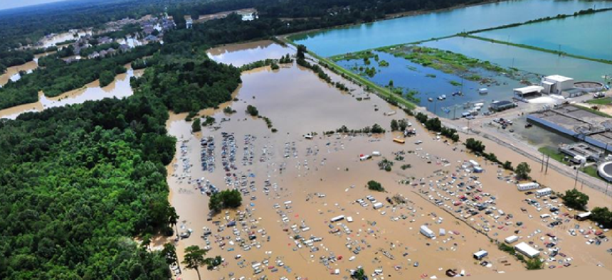
This past month, another devastating flood hit southern Louisiana that left property destroyed and citizens in desperate need of help. While storms and the subsequent damage they produce is something of a constant in these areas, how we respond to them has changed significantly in the decade since Katrina. Technology now allows us to respond to disasters more quickly and with more accurate and up-to-date information than ever before.
One area in which there has been significant improvement is real-time awareness of a natural disaster area’s condition. This knowledge is important for both dispatchers as well as those in the field to understand how a large-scale event is unfolding and where the greatest need for help is. In addition, understanding where traffic jams and transportation obstructions are located helps first responders determine how to get to areas where they are needed most.
Historically, situational awareness was gained through verbal descriptions over radios, hard-copy maps and personal observations. Today, comprehensive situational awareness can be provided through sensors, cameras, GPS and other data streams, all integrated into dynamic maps. These maps provide a real-time picture of an emergency, which can then be shared with those who can act to make a difference.
Now, with the advent of mobile devices, crowdsourced information can also be integrated, adding additional layers to agencies’ authoritative data and enhancing situational awareness. This combination can provide valuable new avenues of information for emergency responders from sources on the ground in and around the emergency.
During the Louisiana floods, crowdsourcing has been combined with official data to resolve a large-scale emergency situation.
Collected sensory data, such as that from river-height gauges and seismic monitors, when combined with geotagged social media information, provides a real-time what, who, why, where and how for enhanced situational awareness. Such data may even assist in predicting unforeseen events resulting from the original disaster.
Government agencies have been cautious in using social media for early warning and response, mainly due to the challenges of vetting, verifying and monitoring such potentially vast amounts of constantly incoming data. However, one solution to the challenge of organizing and making sense of social data is providing it with a geospatial context through geographic information system technology.
This year's Louisiana flood was one of the first attempts to leverage data from the population and then integrate that data back to a place where the public could use it. Downloading and configuring the technology required an app that integrates crowdsourced information with GIS data, which was put together in less than 24 hours.
The challenge for community leaders is ensuring citizens become involved in the crowdsourcing process and know what to do with the data once they have it. The success of Louisiana’s emergency response in the face of the floods has highlighted a new need for increased education, not just to create good “crowdsourcers,” but to build a GIS-savvy workforce, as well. Future members of the community must have the resources and knowledge to take full advantage of these new tools at their disposal.
The next generation of citizens and community leaders will have the skills and tools to be able to make better informed decisions, with complete real-time situational awareness, whether it’s in responding to a natural disaster or just repairing a power line.
Editor's note: This article was changed Aug. 29 to correct the number of years since Hurricane Katrina.

NEXT STORY: How big data can drive cost containment


