DOT launches open National Transit Map


Connecting state and local government leaders
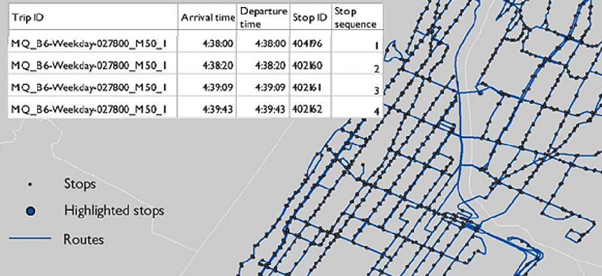
The map was built using information submitted by 270 transit agencies that provided open, machine-readable geospatial data on 398,000 stops and 10,000 routes.
The Department of Transportation launched the first version of its National Transit Map, an open database of information on fixed-route transit services around the county.
The map was built using information submitted by 270 transit agencies that provided open, machine-readable geospatial data on 398,000 stops and 10,000 routes. In March, DOT sent out a request for local transit data, which would supply a missing element in the National Spatial Data Infrastructure database.
Secretary of Transportation Anthony Foxx announced the map’s launch in a blog post where he emphasized the project’s goal of opening up data in hopes that researchers and developers can use it to find solutions to transportation-related issues. But the project will continue to evolve from its current state, Foxx promised.
“We have work still to do to ensure that each transit agency has this kind of data so we can make sure the Map represents all transit service,” he wrote. “We're taking an iterative approach to building this important asset.”
Foxx outlined the primary reasons for needing such a map in a March letter to stakeholders and colleagues:
- Real data on transit system operations will inform planning and help develop performance measures and resiliency strategies.
- A map of existing transit routes helps describe the value of public transportation for those who need it.
“With this information in hand, DOT, planning agencies and researchers can do a far better job of demonstrating the importance and role of transit in American society and identify and address gaps in access to public transportation,” Foxx wrote in March.
Making transit data more available and open could also result in the public viewing the agencies providing the data as more transparent. Additionally, awareness of open transit data could make the public more aware of transit as a result, according to a Transit Cooperative Research Program .
Foxx challenged citizens to use the data to find new transit opportunities across the county.
“We’re getting to work with this data too,” he said, “but we also want to see what you come up with. Share with us any new maps or other cool tools that you create to build connectivity.”


