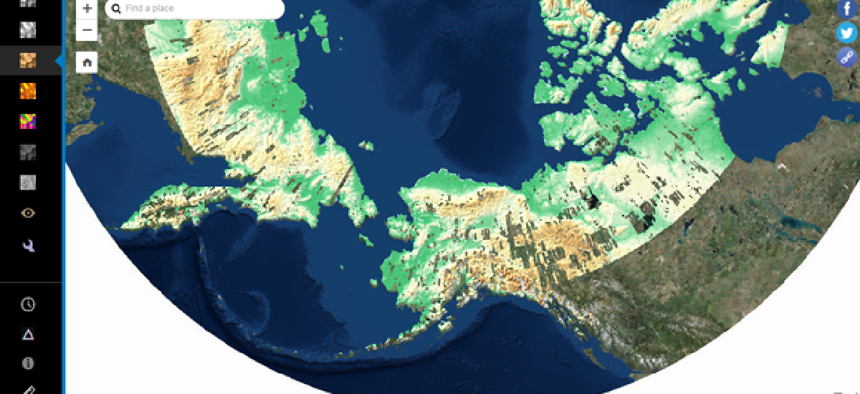
Tracking elevation changes in the Arctic


Connecting state and local government leaders
New data from the ArcticDEM project expands users’ ability to track elevation changes in mainland Canada and Russia.
Arctic researchers now have new high-resolution digital elevation models of a larger portion of the polar region they can use for studying ice melt and other changes in the landscape.
The models are the result of work done by the ArcticDEM project, which was formed by executive order in 2015 to produce high-resolution elevation models to support scientific research and national security in the Arctic. A number federal agencies and universities are partners in the project, which also features an online web mapping portal created by Esri to explore Arctic digital elevation model data.
ArcticDEM has released data from Alaska and other, smaller regions in the past, but this data constitutes the largest release yet, according to NGA.
“The release includes a much broader area of the Arctic geography than ever before, comprising more populated areas that will see a substantive benefit from access to this kind of detailed location data,” Don Kerr, NGA chief of news and information, said in a statement.
New elevation models on the public online portal show surface detail from mainland Canada and Russia and are based on two-meter resolution images captured by DigitalGlobe commercial satellites, according to NGA. This technology allows for more thorough coverage of the Arctic than did traditional imagery collection by aircraft, which is limited in the inhospitable and remote polar region.
The models are created using multiple photos of the same location, which will allow users to track changes over time. Tracking these changes can help communities monitor the coastal erosion that can affect maritime navigational charts that rely on location data.
The satellites are collecting huge amounts of data. Researchers are getting data from areas the size of California every day. These combination of the large areas and high-resolution images creates up to 30 terabytes data a week, according to the University of Illinois, which has the supercomputer that receives this data.
NEXT STORY: Does broadband speed always matter?


