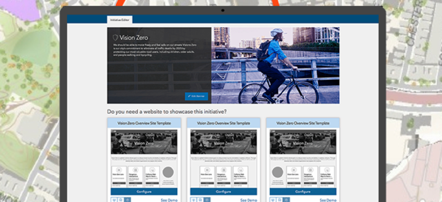
ArcGIS Hub organizes open data around initiatives

Esri's platform lets officials combine their local open data with contributions from colleagues and the community.
When government wants to address broad issues like homelessness or pollution, it needs participation from a variety of constituencies – internal agencies, community leaders and the general public. It also needs a way to make that information open and accessible to stakeholders.
Esri's ArcGIS Hub is meant to put multiple aspects of a government project – open data, geographical information along with surveys and various engagement applications -- in one place where it can be accessed and updated by citizens and officials.
The Hub is designed to make government more efficient at working across agencies and with its citizens, Andrew Turner, the director and CTO of Esri’s R&D center in Washington, D.C., told GCN.
At its core of the Hub is the “initiative” website that might address an issue, such as solving blight, decreasing traffic fatalities or reducing the spread of airborne diseases -- to name a few website templates that are available.
An agency launches the initiative's website through the ArcGIS Hub. The site can include messaging from officials to explain the project, data to show the current state of the initiative and its progress, surveys to provide input and crowdsourcing applications that help gather data to support the initiative.
Citizens can interact with these sites by creating their own content, whether it's surveys or data maps. The government owns and operates the infrastructure, but citizen input can be stored in a “community space.”
If a government is already using ArcGIS products then much of the data is automatically available to the Hub. This means that information like parcel data, tree data, road data, air quality data or other data can be easily connected, Turner said.
The different initiatives can be given different levels of access. A public initiative, for example, can have a dashboard or other aspects that are private. But initiative can also be fully private for internal-facing projects like workplace safety, diversity in hiring or maintenance, he said. Parts of private initiative can also be made public, so, for example, a survey can be conducted publicly for an otherwise internal project.
South Bend, Ind., one of the earliest adopters of the Hub, is using it for initiatives focused on reducing blight and lead poisoning prevention in aging homes.
Esri has also launched initiatives, independent of any particular locality, focused on open data, reducing homelessness and reducing vector borne diseases. There's also Vision Zero, the multi-national road traffic safety project that aims to bring traffic fatalities to zero.
NEXT STORY: Using data to solve business tax noncompliance


