Collecting data on the downpour

Agencies are collecting data on Hurricane Harvey and making it available to emergency response teams.
In preparation for Hurricane Harvey, federal agencies swung into action.
Dalia Kirschbaum, a research physical scientist and disaster response coordinator at NASA, said her office has been working with the National Oceanic and Atmospheric Administration and the Federal Emergency Management Agency since the week before the storm made landfall on Texas’ coast.
NASA’s role is to provide support for storm response through satellite data on the volume of precipitation, the extent of flooding and temperature, she said. Once the data is collected, NASA makes it available for use by any emergency response system.
Satellite imagery and aerial photography from national and international partners will be added to the Hazards Data Distribution System, which is managed by the U.S. Geological Survey. USGS, NASA, NOAA and the National Geospatial-Intelligence Agency have contributed datasets related to Harvey.
Ground-based information is collected from flow meters and storm-tide sensors. Most of the flow meters are permanent installations, though some were added just before Harvey made landfall. Storm-tide sensors are placed closer to the coast.
“This information is crucial for us and for emergency management to actually see how high the rivers are getting [and] what the flood conditions are going to be like, so everyone really watches those gauges,” Michael Lee, a water quality specialist at the USGS Texas Water Science Center, told GCN.
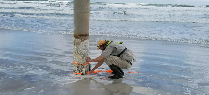
USGS is already receiving requests for the data collected by the storm-tide sensors, he added. A sensor is “put in protective housing, and we will mount or strap it to a structure that we keep our fingers crossed will be in place after a storm comes through,” he said.
USGS sent researchers out on Aug. 29 to collect some of the storm-tide sensors that were deployed along the coast.
To get the flood data to responders, Esri is helping Houston-area agencies launch applications for tracking inundation, supporting search and rescue, and managing traffic, said Chris McIntosh, Esri’s director of national government industries.
The traffic application is similar to what the company created after the I-85 bridge collapse in Atlanta. It combines crowdsourced data from Waze with Esri’s live map to provide information on road conditions.
NEXT STORY: FEMA delivers mobile communications for Harvey


