FEMA integrates GIS tech into hurricane response and recovery


Connecting state and local government leaders
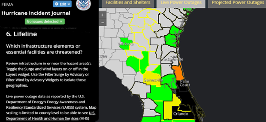
The Hurricane Journal uses geospatial system technology from Esri to combine storm-related information into a cloud-based dashboard for disaster-response decision-making.
When it comes to hurricane preparation and response, data from the National Oceanic and Atmospheric Administration, the National Weather Service, the Department of Homeland Security and the U.S. Geological Survey is needed to inform decisions on how federal and state leaders should proceed.
The Federal Emergency Management Agency Hurricane Journal uses geospatial system technology from Esri to combine information from all those sources into a cloud-based dashboard for disaster-response decision-making.
“While the planning and exercise component of FEMA has the operational planning and decision-making expertise, we worked hand in glove with the chief information officer to research the requirements,” said Joshua Dozor, director of planning and exercises in FEMA’s Response Directorate. That research involved “talking with the operators in the field and at headquarters to determine what specific needs should be in the journal.”
The tool was launched in late September 2016, as Hurricane Matthew hit the Caribbean and South Carolina. It replaced FEMA’s traditional practice of passing static maps among departments for analysis.
The Hurricane Journal draws on data from joint field offices, disaster recovery centers, shelters and other sources. It is organized into sections with maps related to support, resources, assistance, population, building impacts, transportation and infrastructure.
“The journal gives FEMA regional administrators who work with state and local partners…the ability to make the decisions as opposed to a map-maker or geospatial analyst,” FEMA CTO Ted Okada said. “You are giving these key decision-makers the ability to toggle layers on and off the maps to come up with a conclusion based on the probabilistic data that is given.”
FEMA is exploring similar journals for responding to earthquakes, tornadoes and improvised nuclear devices, but officials decided to start with hurricanes because of the high degree of difficulty. Through work with consultant New Light Technologies, FEMA can now update the information on several vectors in real time based on forecasts and resource and personnel needs.
“During hurricanes Harvey and Irma, we opened up the journal to the whole geospatial community, [which] provided surge staffing support,” Dozor said. “And with state and local agencies, we use all of their data and encourage them to share information with us, which makes decision-making better across the enterprise.”


