Congress taps into GIS


Connecting state and local government leaders
Congressional staffers are developing interactive maps that lead to better policymaking and constituent engagement.
Geographic information systems can help members of Congress better serve their constituents by illustrating and mapping local issues.
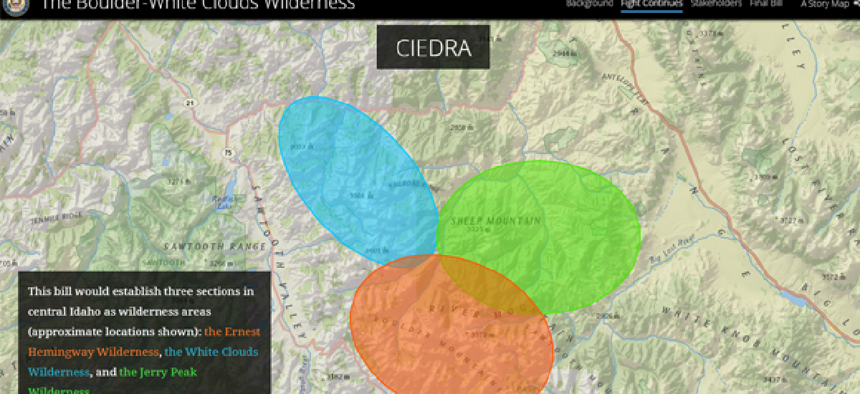
Sen. James Risch (R-Idaho), for example, used Esri’s ArcGIS to develop a set of story maps that helped pass legislation in 2015 to designate the Boulder-White Clouds area in central Idaho as a wilderness preserve.
To move the legislation forward, Risch’s office worked with the Idaho CIO’s office to share information confidentially through ArcGIS on potential boundaries for the wilderness preserve. Public presentations and discussions featuring the story maps gave community residents information they needed to weigh in on the legislation.
Timothy Petty, Risch’s deputy legislative director, said he sees tremendous potential for GIS to shape legislative policy as more congressional staffers learn how to use it. As co-chair of the Senate GIS Working Group, Petty leads quarterly meetings where staffers present some of their recent projects and share lessons learned.
“Most of our staff just want to learn how to use these systems, so we kick off these meetings with someone presenting from an executive branch agency,” Petty said at the Nov. 14 Library of Congress GIS Day. “We try to have a staffer then present on some of their most recent developments and allow staff interactions and questions.”
The Library of Congress maintains the ArcGIS platform for congressional members and their staff to map data from Data.gov for their research and presentations. Petty’s group can connect staffers with federal agency employees if they need more specific information.
The House of Representatives created its own GIS working group last year to share information with staffers, but House Librarian Rae Best said her chamber’s version is starting with the basic building blocks such as map creation to train staff on the ArcGIS capabilities.
Some members of the House are already seeing early results making their GIS applications available online. When Rep. Mark Takano (D-Calif.) began his first House term in 2013, he wanted to get a better understanding of the needs of businesses in his district.
“My staff used GIS software to build an interactive map of all 100 businesses that I visited with pictures from each location,” Takano said.
Takano’s staffers also built an interactive map to examine access to public transit options in his district. Using data from Census and the Riverside Transit Authority, they were able to make a case to local officials to invest in new bus routes.
NEXT STORY: Drones Take Off in a Public Safety Role


