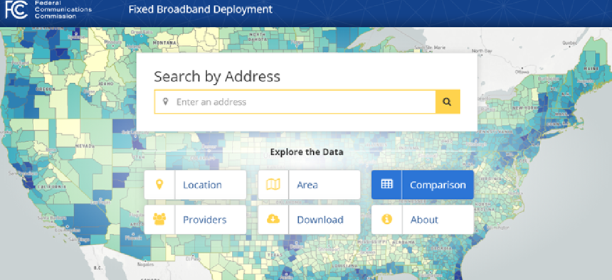
Mapping wireline broadband


Connecting state and local government leaders
The National Broadband Map shows availability of fixed broadband services by census blocks.
As telecommunications providers continue to provide higher internet speeds, information that allows consumers and government officials to compare broadband availability hasn’t been readily accessible. Last year, the Federal Communications Commission began an effort to change that by updating the National Broadband Map with the latest Form 477 data.
Form 477 contains data from all broadband providers indicating where they offer internet service -- at the census block level -- at speeds exceeding 200 kilobit/sec in at least one direction.
The map was launched in 2011 under the National Information and Telecommunications Administration’s State Broadband Initiative. After the program ended, FCC took over the map, but it had not been updated since June 2014.
The relaunched version of the map is a collaboration between the FCC’s Wireline Competition Bureau and the Office of the Managing Director. It incorporates approximately 68 million records from 11.2 million census blocks into a searchable map so users can explore internet access based on geography and provider.
The data on the cloud-based map is from the December 2016 Form 477 filings from telecom companies. Going forward, the map is expected to be updated every six months.
Part of the challenge in creating the map was the volume of data that needed to be compartmentalized, said Steven Rosenberg, chief data officer of the FCC’s Wireline Competition Bureau.
“We wanted to make the data easily accessible with variations easy to see from place to place,” Rosenberg told GCN. “Figuring out the balance of how to simplify the data to make the map work with the technology that exists and still provide the richness of the data that we wanted to share was our main concern.”
"With this tool, we can identify where service is and is not, where facilities are being built and where they are lacking, and how communities are connected and how they are at risk of falling behind," FCC Commissioner Jessica Roscenworcel said in a statement about the updated map. "We have a blueprint for action that will provide everyone from consumers to policymakers with more information."
Currently, the interactive map only has data on fixed broadband deployments, but Rosenberg said the FCC could add information on wireless service in the future. "Adding the wireline data is just the first step, but we have more plans to add features and update it.”
After a presentation at the FCC’s Feb. 22 monthly meeting, Rosenworcel acknowledged that the map is "only half the picture" because it doesn't contain data on wireless broadband. She suggested citizens send comments that would make the map more accurate to broadbandfail@fcc.gov.
Comments still also are being accepted on how to improve the Form 477 collection process through the FCC’s Electronic Comment Filing System. All comments that have already been submitted can be found here.

NEXT STORY: How VA, ICE use data for decision making


