Census mapping tool shows low-response areas


Connecting state and local government leaders
The Response Outreach Area Mapper can help government officials and community leaders tailor their outreach to encourage participation in the 2020 count.
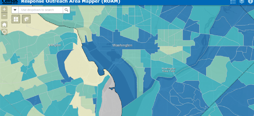
To get an accurate count of nation's population, the Census Bureau depends on state and local government officials and community leaders to get the word out about the importance of every household responding. To help communities tailor their outreach efforts that encourage residents to mail in their census forms, the bureau designed the nationwide Response Outreach Area Mapper that displays the predicted mail-in reply rates by census tract.
The data for ROAM is compiled from the annual American Community Survey, mail return rates from the 2010 census and the low-response score calculated by the Census Geography Division.
“Right now, we are working to update the 2012 to 2016 five-year ACS estimates and the 2018 planning database into ROAM,” Suzanne McArdle, computer mapping specialist in Census' Geography Division, told GCN. “The low-response score is remodeled in every version of our planning database, and it will be more current in ROAM once we run the estimates on the latest five-year ACS data.”
ROAM takes data that was previously printed on paper maps and publishes it through Esri’s ArcGIS public portal, which enables census workers, community leaders and the public to interact with the data directly. Predicted response rates are color-coded to show the census tracts where mailed response is the lowest.
With the easily accessible data on the ROAM site, users can see where response will likely be depressed and drill down to learn more about those communities by checking neighborhood characteristics, median household income and the number of households in multi-unit housing. Low-response areas showing high numbers of non-native English speakers, for example, can be sent census information in the appropriate languages.
“The Geography Division is working every day to create a [tool] for over 140 million housing units so we are prepared for 2020,” Division Chief Deirdre Dalpiaz Bishop said. “When we are working with local governments, we are working with different sources such as the city planning office, tax assessors or the department of motor vehicles.”
“The primary purpose of the census [is] to apportion funds and legislative redistricting, so we want to be sure that we are counting people in the right place,” Bishop said. “We want to educate people on how to use the ROAM tool so they can get the word out in their communities in any way possible.”
Census is also building partnerships to ensure the most accurate count in 2020.
The formation of Complete Count Committees at the county, local, and community levels ensures that local leaders are educating the public on why they should respond to the census. Through dedicated resources and support, these committees can help with outreach in low-response areas and crafting a recruitment strategy.
NEXT STORY: Army boosts efficiency with task management tool


