How simulations ease drone integration

NASA's simulations are helping the agency understand what a future drone traffic management system will look like.
Before package-delivering drones dot the skies, the nation needs a way to efficiently and safely manage unmanned aerial systems similar to the air-traffic control systems used to track and monitor manned aircraft.
NASA is one of the many agencies at the federal, state and local levels contributing to the effort. The space agency has been using computer simulations to understand what this UAS Traffic Management system will look like and the rules and policies that will govern it, according to Joseph Rios, NASA’s chief engineer for its UTM effort.
The simulations that NASA runs fall into three categories: real-time, fast-time and high-fidelity simulations, which allow researchers to run scenarios many times over to refine different concepts.
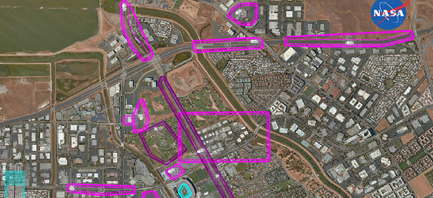
Real-time simulations are 3D displays that show the UTM concept as a whole and what it would look like with a human in the loop, how different vehicles would interact and how people might interface with the system.
“We can see the drones interacting with other drones, so people can point out information about it that they’re observing," Rios explained. "Those displays are really valuable in those simulations.” A real-time simulation can also show how drone operators might react to airspace restrictions that require them to exit the area.
Fast-time simulations use rule-based decisions and statistical analysis.
“We’re looking at scenarios and concepts where there’s different levels of uncertainty involved,” Rios said. “So we can run many iterations of it and pull out some statistical information.”
This kind of simulation would allow NASA to plug in a vehicle model, along with some weather and wind data, place 20 to 30 drones within a square mile and see how the wind affects the drones.
The high-fidelity simulations, meanwhile, deliver a granular understanding of how a single drone or a small number of drones would interact with an environment.
“We can fly this simulated vehicle in this simulated environment and see if the controls are doing what we think they’ll do, what kind of effects the wind model will have on the vehicle model,” Rios said. But these high-fidelity simulations require detailed low-altitude weather models, which NASA has found do not exist.
That’s another important part of NASA's research: finding the data gaps.
“We know a lot about traditional aviation and the appropriate data sources, but when you start to think about the small drones and the things that they’re going to need to keep the airspace safe, we can identify quite a few gaps in terms of available data,” Rios said. “One of the major ones is weather. We have a lot of data on large-scale weather that affects traditional, large manned aviation, but when you start to talk about under 500 feet on small vehicles, you need really high-fidelity weather [data], and that’s not typically available. When it is available, it might just be for a specific location.”
Another gap that exists is in the modeling of the spectrum environment. What happens when many people are connecting to their drones? NASA doesn’t know. But these simulations could be part of figuring that out.
NASA's UTM simulations require too much processing power to run on a normal desktop, but but not enough to tap into the space agency's supercomputer resources. The high-fidelity and real-time simulations run on a network of web servers. The fast-time simulations, however, are run on GPU-powered systems accessed through an Amazon Web Services cloud.
NASA has already completed three demonstrations of basic UTM capabilities. It plans to demonstrate a more advanced system in May 2019 in its first test in an urban environment for applications like package delivery.
“NASA has been doing this work for many years,” Rios said. “We initiated the concept, and we keep driving it forward," he said. "We’re excited to see the future where we can enable a lot more operations in the airspace in a safe, efficient and fair way.”
NEXT STORY: CDOs: Change agents for data-driven government


