Sensing Disaster: Using Tech to Improve Preparedness in New York City

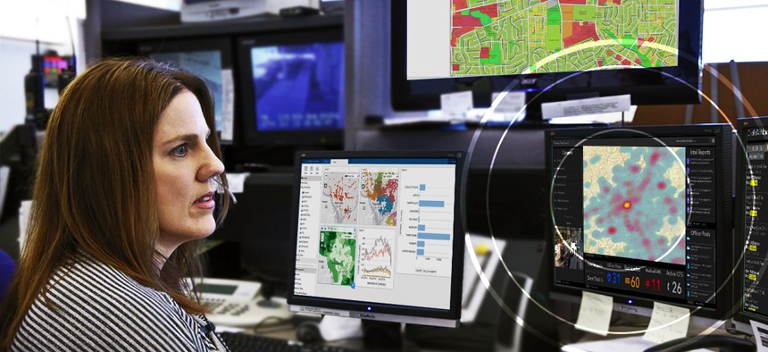
Location intelligence inside control room ESRI
COMMENTARY | Increased adoption of GIS technologies can help New York predict and prepare for future emergencies.
When Hurricane Sandy hit New York and New Jersey on October 29, 2012, the nation’s most populated city was crippled. Sandy’s winds extended out 1,000 miles—more than three times the size of Hurricane Katrina. The storm surge flooded 17 percent of the city’s total land mass. All this resulted in 43 deaths and cost the region $19 billion, mostly due to damage to critical utilities such as sewer, power and water. Many affected communities are still recovering to this day.
With 600 miles of inhabited coastline and a physical location that many scientists believe is susceptible to a major earthquake, New York City’s vulnerability to disaster is one of its biggest liabilities. Since then, many experts have asked, “How can we do better next time?” Looking to the future and adopting new methods to predict and prepare for an emergency is key to answering this question.
International Lessons for Preparing for “The Big One”
In Japan, another densely populated nation vulnerable to disasters, officials are using geographic information system (GIS) technology to better predict the effect of natural disasters in the places where the most people live.
GIS analyzes location data and organizes layers of real-time information into powerful, smart map visualizations. Japanese scientists are using GIS to reveal deeper insights about the physical landscape and population. Looking at patterns, relationships and situations ultimately empowers government officials and city planners to make smarter disaster planning decisions.
The same technology also can help predict potentially critical problems before they occur and identify which citizens are most vulnerable. In one example, GIS is helping officials visually analyze seismographic data collected from sensors installed on thousands of Tokyo buildings to determine how individual buildings sway. This will empower emergency teams to prioritize rescue operations in severely affected buildings and areas and improving overall earthquake response.
Similar technology could be applied in New York to catalogue individual building and neighborhood vulnerabilities. For instance, if the next disaster hits during a heatwave and results in a power outage, rescuing vulnerable citizens, such as the elderly, will be a critical priority. Heatwaves have killed more people in New York City—and the country—than any other weather event. GIS could help rescue officials prioritize response efforts and quickly implement lifesaving rescue operations.
Better Flood Management Could Save Lives and Billions of Dollars
Flooding was one of the most significant issues for the millions of residents in New York and New Jersey affected by Hurricane Sandy. It was the root cause of the major subway damage, and days-long power and voice/data outages in lower Manhattan. In the Rockaways, Breezy Point was among the hardest hit neighborhoods as the 12-foot storm surge leveled numerous homes. Heavily flooded streets also prevented firefighters from putting out fires which consumed 100 more homes.
Additionally, the massive storm surge crippled water treatment plants resulting in hundreds of millions of gallons of raw sewage flowing into waterways in New York and New Jersey. Widespread flooding swamped motors and short-circuited electrical equipment, despite days of preparation by county workers before the storm.
New York is not alone in its vulnerability to flooding. In the United States, flooding disasters represent some of the costliest natural hazard events. In the last 20 years, nearly 60 percent of major disaster declarations were for flooding events.
In an effort to better predict when and where flooding will occur throughout the country, the National Oceanic and Atmospheric Administration has embarked on a transformation of the nation's water prediction capabilities via the National Water Model (NWM). By combining advanced modeling, precise mapping, and real-time data from the United States Geological Survey stream gauges, the NWM is objectively producing high-fidelity forecasts of streamflow for 3.3 million miles of waterways throughout the country.
In Hawaii this year, a new, publicly accessible version will launch which overlays streamflow predictions with weather and climate data—a major leap forward in natural disaster readiness. The new launch will also include a set of experimental flood inundation mapping services powered by GIS, a brand-new capability in impact-based decision support services for water prediction.
Fostering Smarter, More Informed Decisions
New York City still has room and, for now, time to improve its disaster preparedness. Efforts to date have helped the city move in the right direction. Beyond triaging the infrastructure weaknesses that were exposed during Sandy, the city has begun to use available technologies to predict critical vulnerabilities proactively.
For instance, mapping professionals—due to unprecedented cooperation between dozens of city agencies and private utility companies—are already using GIS technology to document all of the water, sewer, gas, telecommunications, and electrical infrastructure systems under the surface of Manhattan to within six inches of accuracy. Once completed, this pilot project will be the world’s most complex underground map.
Having a holistic picture of all interlocking systems that make New York City work would give city officials a more accurate starting point for disaster planning. Instead of guessing what effect a flood will have on the various infrastructure elements in a specific part of the city, officials would know exactly what is vulnerable, empowering them to prepare residents ahead of time and plan response operations, accordingly. This would give New York City an unprecedented tool to harden infrastructure and make certain that the next storm is not as disruptive to the lives of New Yorkers.
David LaShell manages the New York City office for Esri, the global leader in location intelligence solutions, where he focuses on solving urban challenges in partnership with government agencies. He has over 30 years of experience applying location intelligence to some of the largest government, utility, and transit agencies in the US.
NEXT STORY: Framework would make AI decisions less murky


