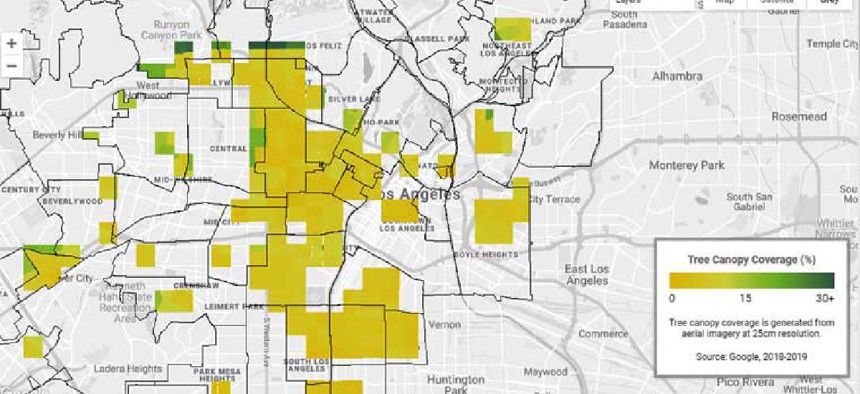
AI shows where cities need trees the most

Google’s Tree Canopy Lab uses aerial imagery, 3D digital surface models and artificial intelligence to estimate and map the density of tree canopy cover and support decision-making related to air quality and heat island risk.
Google has developed an interactive mapping and data platform that local officials can use to learn about the relationship among heat indexes, population density, carbon emissions and tree coverage.
The company’s Tree Canopy Lab uses aerial imagery, 3D digital surface models and artificial intelligence to estimate and map the density of tree canopy cover and support decision-making related to air quality and heat island risk.
Besides using aerial color photos taken from planes in spring, summer and fall, Google added more data about canopy cover from near-infrared photos that detect colors and details outside the visible spectrum. It then compared images from different angles to create a height map.
With specialized AI that automatically scans the images and detects the presence of trees, Google was able to produce a map that shows the density of tree cover, or canopy. Combining those images with population- and climate-focused datasets, the company created interactive maps showing the relationships between trees and the urban landscape
The Tree Canopy Lab allows users to click on an area of Los Angeles to learn about the tree coverage, land use and land type by neighborhood as well as the average heat health index and population density. The Los Angeles map incorporates data from City of Los Angeles Boundary Data, City of Los Angeles Land Use, EnviroAtlas, the California Heat Assessment Tool, and the Center for International Earth Science Information Network at Columbia University.
The tools showed that more than 50% of Angelenos live in areas with less than 10% tree canopy coverage and 44% live in areas with extreme heat risk, Google officials said in a blog post. Conversely, they wrote, “we also see a correlation that shows parts of Los Angeles with the lowest heat risk also have the highest tree canopy coverage — these areas are also the lowest population density of Angelenos.”
The Environmental Protection Agency has recommended cities plant trees to both lower street-level temperatures and improve air quality, storm water management and quality of life. Yet many cities lack the resources to inventory their trees or investigate where planting new ones could yield the greatest benefits.
The 2019 Los Angeles sustainability plan set a goal of planting and maintaining 90,000 trees as well as completing a citywide tree inventory by 2021 as a way to not only beautify neighborhoods but also cool them down.
With the Tree Canopy Lab, “[w]e’ll be able to really home in on where the best strategic investment will be in terms of addressing that urban heat,” Rachel Malarich, Los Angeles’ first city forest officer, told The Verge.
The Tree Canopy Lab will also save cities from having to manually inventory their trees because the images will be regularly updated from images the company takes for Google maps.
“Every tree we plant can help stem the tide of the climate crisis, and when we expand our urban forest, we can sow the seeds of a healthier, more sustainable and equitable future for communities hit hardest by rising temperatures and intensifying heat waves,” Garcetti said.
The Tree Canopy Lab launched with data on Los Angeles, but the program plans to expand to hundreds of locations. City officials interested in participating can sign up here.


