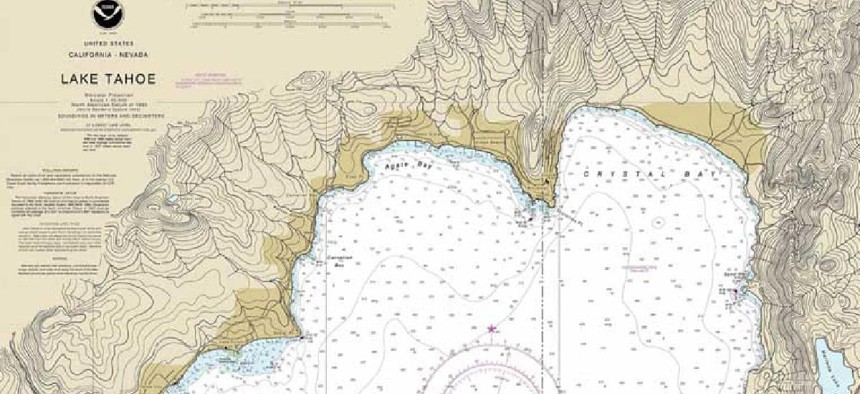
NOAA rolls up paper charts

The National Oceanic and Atmospheric Administration has stopped offering the paper and associated raster versions of the marine navigation chart for Lake Tahoe, the start of NOAA’s move to fully electronic navigational charts.
The National Oceanic and Atmospheric Administration has stopped offering the paper and associated raster versions of the marine navigation chart for Lake Tahoe – the first chart to be sunsetted under the five-year plan to move to fully electronic navigational charts (ENCs). After August, the agency said in a Feb. 26 announcement, the electronic version will be the only NOAA nautical chart of the area.
The Lake Tahoe chart was selected to test the various system modifications required for ENCs, which provide a detailed representation of the U.S. coastal and marine environment. Going forward, the only updates NOAA will apply to the updates of raster charts are those critical to navigation, such as the location of newly discovered shoals or changes to buoys. Routine information, such as shoreline survey data, will only be updated in the ENCs. If the two versions get too far out of sync, the raster chart may be cancelled earlier.
The traditional paper charts and their raster versions that have been published by NOAA and the Coast Survey have been used for over 170 years. The ENCs, however, will contain more detailed information, are easier to maintain and update.
The ENCs are vector datasets that are used by large commercial vessels and recreational boaters for real-time ship positioning, as well as collision and grounding avoidance information, agency officials said. NOAA’s ENC Direct to GIS tool that allows users to display, query, and download all available base editions ENC data in a variety of GIS/CAD formats.
When the changeover is complete, NOAA will have over 9,000 ENCs that offer better data consistency and more detailed coverage. Through the four-year transition, NOAA will provide access to paper products based on electronic data. Using the NOAA Custom Chart tool mariners can create their own paper and PDF charts from the latest ENC.
Previous editions of all NOAA charts, including the “last-edition” of each paper nautical chart, can be downloaded for free from the NOAA Historical Map and Chart Collection website, the agency said. Nautical charts, other maps and documents, dating back to the mid-1800s, are included in the collection.


