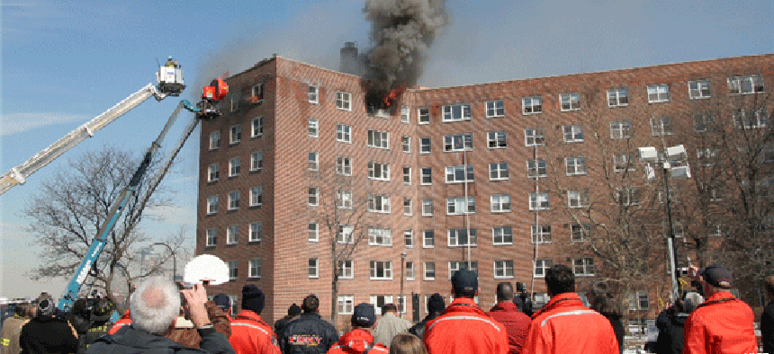
Z-axis tech keeps responders safe

Vertical location services can give emergency workers vital situational awareness and help keep them safe when responding to incidents in multistory buildings.
Vertical location services can give emergency workers vital situational awareness and help keep them safe when responding to incidents in multistory buildings.
NextNav’s Pinnacle altitude service, which provides a z-axis in addition to traditional x and y coordinates, is available through another situational awareness platform called Intrepid Response for FirstNet. The service is live in 4,400 cities and towns nationwide, covering more than 90% of buildings that are taller than three stories, said Chris Gates, vice president of strategy and development at NextNav, a 3D location company.
“If you think about the geolocation market, it’s generally been a 2D market, and so services are provided with horizontal coordinates,” Gates said. “They’re often plotted on a flat map, especially in urban environments. The world, of course, is not flat, and our personal space and awareness and context is largely defined by vertical spaces as well as horizontal spaces.”
NextNav uses cloud services platform to process the location data. First responder applications that integrate the software -- such as Intrepid Response’s -- can interact with the platform and deliver altitude information. That application lets first responders share their location among defined groups and teams and with commanders and incident managers. With Pinnacle, that information includes altitude with an accuracy of plus or minus three meters.
The software predominantly uses barometric pressure to determine altitude, and most smartphones sold in the United States have barometric pressure sensors. Those work with NextNav’s network and the cloud platform to calculate altitude, which can be illustrated in many ways, Gates said, such as showing a dot on an altimeter or as a number in feet off the ground.
For instance, when responders are putting out a fire in a multilevel building, they need to know that they have 10 workers on one level and two on another -- something that they can see at a glance with the z-axis.
“You can have a very current of what a team is doing,” Gates said.
NextNav’s technology works on any device. Its software development kit is available for Android and Apple iOS devices, but any device with a barometric pressure sensor and a data connection will work, Gates said. Additionally, the software is available in the FirstNet application programming interface catalog so that other public-safety apps can integrate the technology.
The solution is part of Z-Axis for FirstNet, which AT&T calls “the next evolution of FirstNet Enhanced Location Services,” specifically providing responders “with the vertical reference point in terms of height above terrain to indicate the relative altitude or vertical location of the first responder and their team members,” according to a news release.
Improving situational awareness and navigation for responders is also a priority at the Homeland Security Department’s Science and Technology Directorate, which joined with NASA’s Jet Propulsion Laboratory to test the Precision Outdoor and Indoor Navigation and Training for Emergency Responders technology’s ability to track responders indoors on x, y and z axes. S&T’s First Responder Resource Group and Balboa Geolocation tested multiple POINTER devices for tracking, visualization and data collection capabilities.
The test, conducted in December 2020 and announced Jan. 8, took place at the Veterans Affairs Department’s Greater Los Angeles Healthcare System. The POINTER command station, transmitters and receivers were deployed in a five-story 8,000-square-foot structure intended to represent a residential VA facility. At a distance of up to 70 meters, POINTER accurately located responders wearing cellphone-size receivers in 3D within 1 meter throughout all levels of the building.
Additional testing will continue throughout the year, and a commercial product will be available in early 2022, according to a DHS news release.
“Many existing tracking technologies use GPS, Ultra-Wideband or other identification methods that rely solely on radio position location -- these can suffer reduced performance in non-line-of-sight and indoor environments,” the release states. “POINTER, on the other hand, uses magnetoquasistatic fields to three-dimensionally orient and track responders in emergency settings, helping incident command pinpoint their location within 1 meter.”
Magnetoquasistatic technology is often deployed in sensor applications where a clear line of sight is not available. POINTER uses it to geolocate individuals even in rural environments compromised by dirt, water or thin metals, according to S&T. The entire system consists of receivers worn by first responders, transmitters on emergency vehicles and a base station laptop with software to track and display the receivers’ locations visually. It does not require a large network of built-in infrastructure.
Initially intended for firefighters, S&T says POINTER could also be adapted for law enforcement and military missions, border security and disaster response as well as internet-of-things supply chain tracking, smart cities indoor navigation, robotics, mine safety and more.


