White House experiments with augmented reality


Connecting state and local government leaders
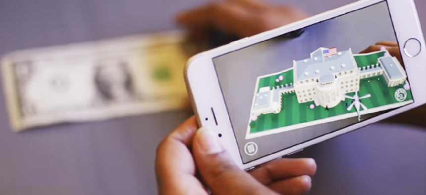
An animated White House will appear on any $1 bill when viewed with the new 1600 app.
Not many people get to visit the White House, but thanks to a augmented reality application from the White House Historical Association, the experience is a little more accessible.
After downloading the app, titled 1600, users are prompted to pull out a $1 bill and point their phone or tablet’s camera at it. Animations of the White House and surrounding lawn then pop up, and Press Secretary Josh Earnest describes why the building is important.
There aren’t many practical applications for the 1600, but White House stressed the importance of trying out new technology.
“From hosting festivals on the South Lawn to allowing people to explore its rooms via Google Street View, President Obama has used traditional events and new technology to open up the doors of the White House to more Americans than ever before,” Earnest said in a statement.
Following this summer’s popularity of Pokemon Go, conversations began about how government could leverage the AR technology.
Pokemon Go could be used to increase civic participation by residents who could point out potholes or graffiti as they play the game, Miguel A. Gamiño Jr., the current CTO for New York City, wrote on Medium while he was serving as the CIO of San Francisco.
“If we think bigger,” Gamiño wrote, “it seems the potential is not the game itself, but rather the platform that’s using augmented reality to motivate a highly engaged base. What if the platform allowed local governments to add a digital layer to any streetscape? We could intentionally leverage it to communicate planned street closures, permitting applications for businesses, or a whole host of things we currently struggle to communicate for better interactions with our constituents.”
AR and virtual reality could play a big role in understanding data, Michael Thomas, a software architect at SAS, suggested. “By using VR and AR hardware and software to look at the information produced by visual analytics programs, the government could instantly map data into a representation inside of a virtual environment.”


