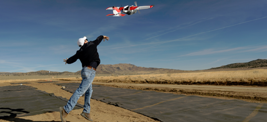
NASA tests drone traffic management

The agency wrapped up second-level testing for its cloud-based unmanned aircraft systems traffic management platform.
NASA wrapped up the second level of testing for its cloud-based unmanned aircraft systems traffic management platform.
The three-week campaign for Technology Capability Level 2 (TCL2) demonstrations were conducted at six Federal Aviation Administration-designated UAS test sites and focused on beyond line of sight flight capabilities. TCL1, which concluded in December 2015, tested flight plan submission and flight plan approvals associated with agriculture, firefighting and infrastructure monitoring.
Along with the Federal Aviation Administration, state and local governments, university partners and private companies -- including Project Wing, part of Google’s parent company, Alphabet – participants flew drones through different hypothetical scenarios, including package deliveries, farmland surveys, search and rescue operations, railway inspections and video surveillance operations.
In Reno, Nev., five different drones flew multiple operational scenarios, including parachute-initiated emergency supply deliveries and aerial survey operations. Participants tested the drone mapping technology and sensing and radar systems that integrate with NASA’s UAS Traffic Management (UTM) research platform.
“We flew the longest multi-faceted NASA UTM flights to date in Nevada,” said Chris Walach, director of the FAA-designated Nevada UAS test site. The data from the test “will go a long way toward advancing the UTM for the FAA and the UAS industry,” he said.
“The TCL2 trials demonstrate that technologies for geofencing, data exchange and more can enable safe and sophisticated drone operations, even beyond line of sight,” said Steve Willer, business development manager for AirMap, which participated in the Reno trials.
Similar demonstrations took place at the Griffiss International Airport in Rome, N.Y. That test, which involved four drones being flown from a command center for the first time, looked at what happens when drones deviate from their flight plans. A secondary goal of the test was for the drone pilots to recognize that deviation and figure out what to do about it, Chuck Hereth, chief pilot for Northeast UAS Airspace Integration Research Alliance, told the Utica Observer-Dispatch.
At the Blacksburg, Va., test site, Project Wing tested both its Wing aircraft and its UTM software, demonstrating that multiple drones from different manufacturers can fly in the same area. Last fall, Project Wing delivered burritos to Virginia Tech students in the first public UAS delivery tests on U.S. soil.
“Operators have historically had to steer their aircraft away from obstacles manually,” James Ryan Burgess, Project Wing co-lead, said in a blog post. "[I]nstead, we demonstrated yesterday that our UTM platform can automatically manage the flight paths of all these different types of UAS, planning new, clear routes for each aircraft if and when conflicts arise."
Wing is one of several UAS service providers working with NASA on development of third-party UTM software to interface with NASA’s central research platform.
These latest tests demonstrate the power and flexibility of NASA’s traffic management research platform, according to Tom Prevot, NASA’s UTM project lead. “The UTM platform is capable of coordinating and analyzing inputs from dozens of sources, making valid and reliable assessments of the local airspace environment, and communicating safe flight opportunities to pilots in the area,” he said.
“The flight tests also demonstrated that the concepts and ideas behind UTM TCL2 will work, but there's still a need for a common operating picture where everyone gets more airspace awareness,” Prevot said. “Implementing a UTM system will foster coordination and education on how to safely share the airspace.”
Later this year, NASA expects to launch testing for Technical Capability Level 3, which will fly drones over more-populated areas and in the presence of larger, piloted aircraft.
“The TCL3 team will need to assess ground-based airborne surveillance systems and how to safely fly in higher density airspace,” NASA officials said. “Vehicle-to-vehicle communications also will be evaluated to permit suburban delivery activities.”
NEXT STORY: Internet fast lane for first responders


