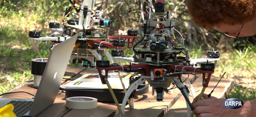
Flying drones without GPS, human guidance

DARPA's Fast Lightweight Autonomy program is developing algorithms that work at high speed in real time with off-the shelf drones.
Unmanned aerial vehicles have already proven to be useful for a number of different tasks, from military surveillance to inspecting the undersides of bridges to finding missing persons, but they require an operator and a GPS signal, which will not always be available. That is why the Defense Advanced Research Projects Agency is working to improve the autonomy of UAVs.
DARPA recently brought three teams of researchers to central Florida to participate in the first phase of the Fast Lightweight Autonomy program, which is an effort to develop algorithms that can be used to make lightweight, off-the-shelf air- or ground-based drones operate without human guidance, access to GPS or any datalinks going to or coming from the vehicle.
"Small, low-cost unmanned aircraft rely heavily on tele-operators and GPS not only for knowing the vehicle’s position precisely, but also for correcting errors in the estimated altitude and velocity of the air vehicle," DARPA FLA Program Manager JC Ledé said. "In FLA, the aircraft has to figure all of that out on its own with sufficient accuracy to avoid obstacles and complete its mission."
The teams were asked to fly drones through a number of obstacle courses that included wooded areas and warehouse interiors. A picture of the drone’s final destination was uploaded to the on-board flight computer along with the target's compass direction and distance. With this information – along with cameras and sensors -- the drones avoided obstacles and navigated to their targets. On the final day, the drones had to fly through the woods, across a bright parking lot, through the open door to a dark hangar where they had to maneuver around walls and obstacles inside, locate a red chemical barrel as the target, and fly back to their starting point, completely on their own.
Not all of the flights went according to plan. Some drones crashed, some got lost and returned to the starting point and on a few occasions, humans had to correct wrong turns. But the researchers made adjustments to their algorithms, uploaded the software to the drones and tried again.
Success was largely a matter of superior programming, DARPA said. “FLA is not aimed at developing new sensor technology or to solve the autonomous navigation and obstacle avoidance challenges by adding more and more computing power,” Ledé said. “The key elements in this effort, which make it challenging, are the requirements to use inexpensive inertial measurement units and off-the-shelf quadcopters with limited weight capacity. This puts the program emphasis on creating novel algorithms that work at high speed in real time with relatively low-power, small single-board computers similar to a smart phone.”
DARPA sees this technology being useful in military and first responder scenarios, particularly in areas with poor or no access to GPS signals like underground and inside buildings.
"We’ve still got quite a bit of work to do to enable full autonomy for the wide-ranging scenarios we tested, but I think the algorithms we’re developing could soon be used to augment existing GPS-dependent UAVs for some applications," Ledé said. "I think that kind of synergy between GPS-reliant systems and our new FLA capabilities could be very powerful in the relatively near future."
NEXT STORY: Las Vegas Begins Its Smart City Push


