Using GIS Mapping for On-the-Ground Situational Awareness During the Eclipse

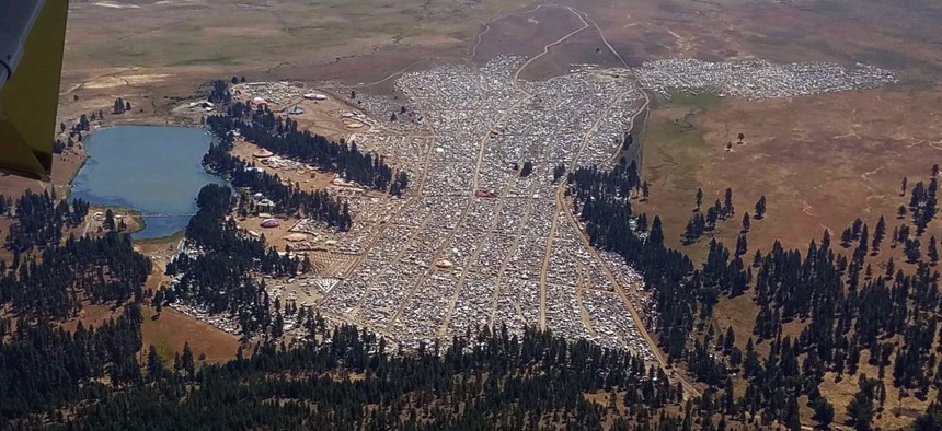
The crowd at the Big Summit Eclipse 2017 event near Prineville, Oregon. Oregon State Police / AP Photo
A massive influx of visitors to places along the “path of totality” is a public safety challenge and operational challenge.
Casper, Wyoming is among a handful of U.S. cities, along the “path of totality” of Monday’s solar eclipse, employing geospatial tech for heightened situational awareness during the once-in-a-lifetime astronomical event.
Anywhere from 1.85 to 7.4 million people will travel to locations along the path to witness the total solar eclipse, and for cities like Casper that massive influx of visitors amounts to a public safety issue.
Casper is hosting the Wyoming Eclipse Festival, and the city added a Solar Eclipse 2017 layer to its GeoSMART webpage highlighting the location of traffic restrictions, parking, events, viewing sites, camping accommodations, parks and trails, first aid stations, and clinics and hospitals along with wait times.

“When you’re thinking about where things are and what’s happening, context is critical,” said Chris McIntosh, Esri national government industries director, by phone. “Bringing the right group of layers together to tell the right story is the name of the game.”
The Redlands, California-based GIS software company helps cities prepare residents and visitors for any incident affecting their jurisdiction, including weather events like tornadoes and winter storms. By making location-specific data and other information more easily accessible, local decisionmakers and other stakeholders can manage resources more effectively.
Most states and local governments along the path of totality have been preparing for six months or longer to ensure transportation and other support elements are in place to handle many more visitors than usual staying for a longer-than-normal amount of time.
While there are nuances specific to each locality, Salem, Oregon, the first major city along the path of totality is using the same core workflows and methodologies as Casper.
“My hope is everybody will learn lessons, and they’ll share that knowledge,” McIntosh said. “That way, cities can improve everybody’s preparation level for future events.”
Dave Nyczepir is a News Editor at Government Executive’s Route Fifty and is based in Washington, D.C.
NEXT STORY: More Good News for a Promising Earthquake Early-Warning Tool


