Kansas City Enters ‘Phase 2’ of Its Smart City Transformation

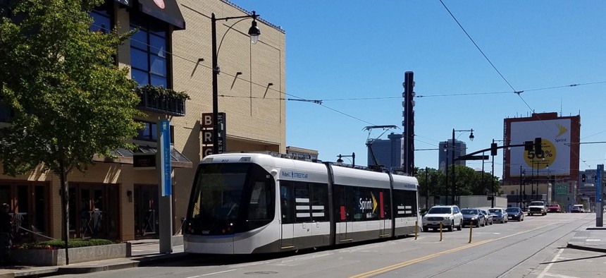
A streetcar vehicle moves along Main Street in downtown Kansas City. Michael Grass / Route Fifty
“There is a greater value to the data we maintain as a city than we anticipated,” according to the city’s chief innovation officer.
Kansas City, Missouri is entering the second phase of its smart city program with greater appreciation for sensor-generated data and its ability to finetune algorithms to predict future behavior.
The city deployed more than 325 public access Wi-Fi points and 128 smart streetlights across its 54-block downtown streetcar corridor, which feeds into a data lake aggregated by Cisco Kinetic for Cities.
That data resides in the Amazon Web Services cloud, which urban intelligence platform Xaqt distills into insights on everything from real-time traffic and downtown parking to the relationship between high-speed internet access and the poverty rate.
“There is a greater value to the data we maintain as a city than we anticipated,” Bob Bennett, Kansas City’s chief innovation officer, told Route Fifty by phone.
Kansas City is a lead anchor customer, or “smart node,” on Xaqt’s MetroGraph platform, a decentralized data plane spanning clients’ metropolitan areas.
In mid-to-late March, the city will expand its digital footprint with a request for proposals on additional kiosks and Wi-Fi access points in the eastern third of Kansas City along Prospect Avenue, where a new bus rapid transit line is planned.
A proposed extension of the existing streetcar line would bring service six miles south through the Westport and Country Club Plaza entertainment districts and ending at the University District. An expansion of smart water meters into new area of the city is also planned.
Smart streetlights detect traffic and parking patterns along with pavement sensors and video cameras monitoring pedestrians, vehicles and left-turn tendencies. Other systems along Main Street manage adaptive traffic light and parking controls, as Route Fifty explored during a previous visit to Kansas City.

Xaqt uses that data to define economic opportunities and public safety from a behavioral perspective.
“It’s always good to know where somebody can put a coffee shop,” said Chris Crosby, Xaqt’s founder and CEO, in a phone interview.
Looking at how people move about the downtown corridor, Xaqt’s data scientists can identify highly trafficked areas, and third-party data from 5,000 connected vehicles coming soon scales this ability to the entire metro area.
Citizen and visitor journeys, including transportation modes and destinations, are anonymized outside of the area code of the phone being used.
Regarding infrastructure, Kansas City launched a street maintenance prediction tool, or pothole predictor, about six months ago.
“It’s allowing us to understand roads not as a cold, hard, stationary objects but as a living, breathing things impacted by weather, traffic, types of traffic and age,” Bennett said.
Analytics show the city where roads are aging more or less quickly to make street maintenance preventative instead of repairative.
Potholes result from the expansion and contraction of the asphalt, so advanced cracking is a precursor. Xaqt looks at things like permitting data and bus routes to estimate wear and tear on pavement and generate a forecast where maintenance should be focused.
Bennett said he hopes to eventually save 50 percent on emergency road repairs using regularly scheduled labor instead of overtime workers and avoiding the use of quick-curing asphalt that makes the road brittle. The city spends $8 to $10 million a year on road maintenance despite only budgeting between $3 and $6 million, which has created a $40 million work backlog the CIO could wipe out in five years if all goes well.
In nine days, Kansas City will see the first in a series of freeze-thaw cycles that will test Xaqt’s algorithm, so the city will know in 68 days if it works as designed.
The platform is also helping identify vacant structures often needing repairs with 85 percent accuracy by analyzing building permits and traffic patterns. That information is vital to police and fire personnel responding to an emergency in a building they’d rather not walk into blind.
Xaqt’s model was fed a list of known vacant properties and known occupied properties to help it better identify the factors indicative of both, so now users can click on a parcel and see what the model predicts—subsequently validating the response so it can adjust and reforecast.
“It takes a full ecosystem to make this thing work,” Bennett said. “Smart City Media, Xaqt, AWS, Cisco, and Sprint—increasingly you’re going to see the individuals competing within yours on one day collaborating in the next city the next day.”
PREVIOUSLY on Route Fifty:
Dave Nyczepir is a News Editor at Government Executive’s Route Fifty and is based in Washington, D.C.
NEXT STORY: Air Force seeks 'virtual wingman' for intel analysts


