Partnership boosts geospatial data sharing across jurisdictions


Connecting state and local government leaders
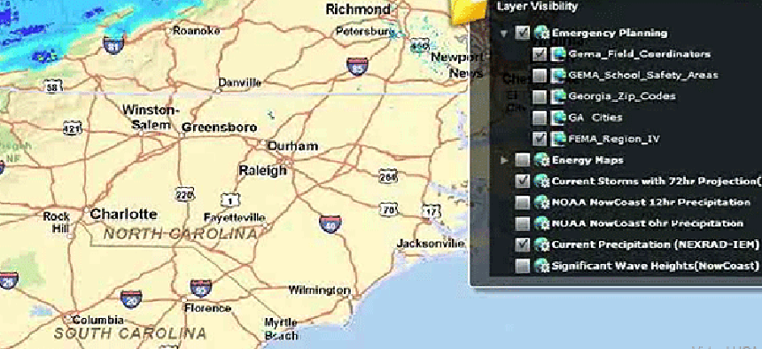
NISC adopts Esri's ArcGIS Online platform for Homeland Security's Virtual USA Program, which provides a 3-D platform of interactive maps showing critical assets during emergencies.
A partnership between The National Information Sharing Consortium and Esri could improve the sharing of geospatial information among federal, state and local government agencies during natural disasters or emergencies.
Esri’s ArcGIS Online for Organizations (AGOL) will be deployed as a GIS platform to support the Homeland Security Department’s Virtual USA Program (vUSA), which provides interactive maps that display the location and status of critical assets, including helicopter landing sites, evacuation routes, shelters, gas supplies, water lines and power grids, according to a release.
AGOL is a cloud-based mapping portal that lets emergency management personnel share maps and data with each other and the general public from any device, Web browser or desktop application. The deployment of an AGOL portal that is compliant with vUSA will significantly enhance state and local agencies’ ability to participate in the vUSA program, since AGOL has been widely adopted by these agencies, NISC officials said.
Esri officials endorsed the vUSA initiative in 2010, expressing their commitment to make certain the geospatial company’s technologies supported the goals of the program. The partnership with NISC will accelerate the establishment of shared situational awareness and information sharing capabilities, Esri officials said.
Six pilot projects involving over 35 states have been conducted since 2009 to demonstrate vUSA’s ability to support near real-time information sharing. U.S. federal, state and local governments; Canadian provincial and federal governments; non-governmental organizations; and private-sector partners have participated in vUSA since the first pilot was conducted, NISC officials said.
NISC, in collaboration with DHS’ Science and Technology Directorate’s First Responder Group and the first responder community, are using pilot programs as the basis for transitioning vUSA technologies from prototypes to platform components that will not only be interoperable with existing systems as well as those information sharing efforts already in progress, officials said.
Other GIS-based public-sector IT sharing projects are in development. The National Geospatial-Intelligence Agency and the geospatial community are creating a cloud infrastructure to demonstrate how a coalition of organizations can share geospatial information as they respond to natural disasters around the world.
NGA officials want to see how industry can deliver open, standards-based geospatial data to first responders via multiple, interoperable cloud infrastructures, Todd Myers, NGA’s lead global compute architect, told GCN during a recent interview.


