Mapping the future for GeoPlatform.gov


Connecting state and local government leaders
Improvements to the nation’s online platform for geospatial resources include semantic search, application program interfaces, advanced developer tools and service monitoring and metrics.
GeoPlatform.gov, the web portal that provides direct access to the nation’s online geospatial resources, was launched in 2011 by member agencies of the Federal Geographic Data Committee (FGDC). In the last 18 months, however, GeoPlatform.gov has shifted into high gear as it works to make its assets more usable with high-performance web services and better tools for managing the data.
The platform serves as shared cloud host for data and applications, where users can easily access geospatial data and create communities. The site’s open mapping tools let users discover data, use the data to build a map, save and share the map, embed it onto their own webpages. “The basic building blocks are there,” the Interior Department’s Jerry Johnston, director of the Information and Technology Management Division and a member of the FGDC Steering Committee, told attendees at a recent AWS event in Washington, D.C.
However, Johnston wants to make all the nationally available geodata available for interoperable web services. “There’s a very small subset of those datasets that we have that are actually readily available in those formats,” he said.
The site’s data is pulled from Data.Gov, but the department is trying to advance its usability by making GeoPlatform’s metadata machine-readable and linking the platform to other online semantic registries. That would allow the platform to suggest, for example, maps similar to the one a user is building or an additional data layer suited for the map based on what other users have built.
To do so, FGDC will improve its metadata content and build its own registry to keep track of how people are using the metadata, how people add datasets to maps and how they share them with each other.
A new performance dashboard for registered users has tools to measure, monitor and report on the quality of National Geospatial Data Assets (NGDA) and services. It checks how available the data is and assesses the quality of the service.
Johnston and his team plan to take the dashboard further, from simple qualitative measures to essentially a report card for the NGDA services. The dashboard would gather data on the speed of NGDA service response, measure service reliability, ensure datasets are available through high-quality and high-performing web services and measure the use of the datasets. Johnston said this functionality could be released sometime next calendar year.
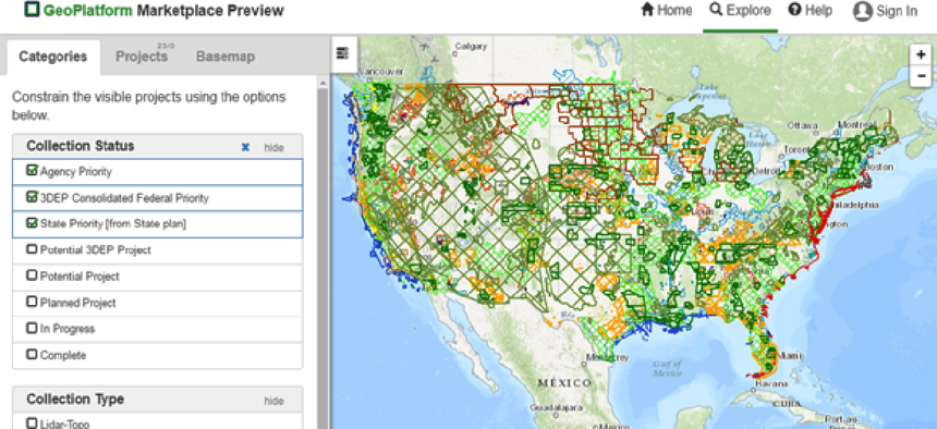
Plans are also in the works for improving the GeoPlatform Marketplace, a social space where users can discuss the data they’re collecting, store projects and view a list of all the planned data acquisitions and datasets agencies are interested in. Eventually, Johnston said he hopes it becomes the “Craigslist for geodata,” where users can buy and sell data, make deals, create partnerships and, in time, open it to the private sector.
Ultimately, the department plans to take GeoPlatform beyond the website to include a platform with application program interfaces and developer tools that could help people get access to the data and services. “We need to build tools that enable people to take functionality, content, tools, data… in GeoPlatform.gov and embed them into their own applications,” Johnston said.


