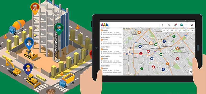
Map-based tool for transportation-related asset management

SADA Systems’ Atom is a cloud-based solution for managing and tracking regional road structure assets, projects and field personnel.
A cloud-based solution that could help transportation planners better manage and track regional transportation assets, projects and personnel is now available for government agencies.
Atom aggregates data on bridges, highways, signs, team members and other assets in a software-as-a-service environment with analytics and reporting tools. It’s meant to provide multiple transportation-related departments with a single map-based tool to manage resources, monitor projects, analyze risk and assign personnel, according to company officials.
Technology consulting firm SADA Systems and Collins Engineers, a provider of transportation-based engineering services, developed the application, which has been used by the Chicago Project Coordination Office to collaboratively manage, create, edit and resolve overlapping project issues.
Atom consists of multiple components, including separate portals for maps, inventory, work orders, risk analyses, analytics, scheduling, team management and public data. It uses Google Maps technology for routing, navigation and displaying location data across departments so supervisors can see the proximity and availability of a user, team or asset.
Additional mapping tools like linear reference systems and Esri’s ArcGIS can also be used to map data points, and templates can be saved and later accessed by specific users or roles. Google Maps also shows the weather and traffic impact on field activities so agencies can improve time management and decision making.
Inventory tools let users customize and filter through a list of inventories related to their field of work. Through the work order portal, supervisors can manage assigned tasks and schedules and follow the entire lifecycle of a project. The risk management dashboard displays risk factors of assets and measurements of failure probability, and an analytics portal shows all the data with graphics to summarize trends.
According to the company, the Atom also taps Google’s analytics and machine-learning capabilities and uses a Google Cloud platform. It accepts a number of data formats, and restructures information for input and export. This feature could be helpful for agencies working with older systems. Along with Esri data, Atom can pull data from SQL databases, CSV and CAD files.
Atom also allows administrators to limit user and team access to certain features with permission controls and to decide which real-time information to make public. On the public portal, citizens can track assets like snowplows or the progress of projects and engage through feedback or requests.
In terms of implementation, the tool is a web-based app using Google’s Material Design assets and does not require any installation or additional technology other than a desktop, tablet or smartphone. And according to a company spokesman, though the tool is a cloud solution, agencies are able to store information on-premise.


