Smartphone cameras monitor road conditions


Connecting state and local government leaders
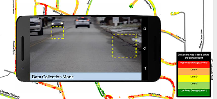
The RoadBotics web-based app collects roadway data through the camera on any smartphone and delivers analysis of that data via the cloud.
Road maintenance in North Huntingdon Township, Pa., has historically relied on the knowledge of public works directors and engineers or the preferences of elected officials. But Mike Turley, assistant township manager, wanted something more concrete for monitoring the hundreds of miles of roadways that traverse North Huntingdon Township.
“Doing some scientific method for how to rate and schedule road maintenance and resurfacing can be a challenge,” Turley said. He and his team first created a manual, labor-intensive process that involved inventorying all the roads; grading them with an A, B, C, D or F; rating them; and numbering them in a spreadsheet along with details about what was wrong and cost information. The result was a plan for fixes over a decade at a cost of about $1 million per year.
Then Turley found out about RoadBotics, a web-based app that collects roadway data through the camera on any smartphone and delivers analysis of that data via the cloud.
“We took immediate interest in it because it’s so labor-intensive to do it manually,” Turley said. “You’ve got two guys out there writing information on sheets, coming back and putting it into a database. It takes a long time. You can collect the data faster” with the app.
To use RoadBotics, users mount their smartphones against the vehicle’s windshield with the camera facing out. The phone then collects information on cracks, potholes and other problems as the driver goes about business as usual. What’s more, the app identifies problems not only on the surface, but also on the edge of the road, including signs.
“If you can see it as a driver, we can see it too,” RoadBotics CEO Mark DeSantis said. “Then all that data is uploaded to the cloud, to our platform, and then our platform commences the analysis with everything that vehicle has seen along the roadway.”
The data is stored locally on the device until it senses a friendly Wi-Fi connection. Then the platform pulls all the data out of the phone and into the cloud for analysis, where machine and deep learning find anomalies and provide a qualitative assessment, DeSantis said.
At the end of a day of data collection, public works officials will see a map with green, yellow and red markings. They can click on those to see what’s causing the rating. The information includes date and time stamps plus an image of the problem that needs to be addressed. The RoadBotics data can also be exported to common GIS mapping formats so that information can be ported and integrated into existing roadway inventory management systems.
RoadBotics got its start with Christoph Mertz, a roboticist at Carnegie Mellon University, who saw the app as a way to help cities manage transportation resources. It became a company last December, and DeSantis said additional capabilities are in the works.
For instance, the federal government requires state and local governments to regularly evaluate the retroreflectivity -- how light is reflected from a surface -- of signage. To do this, most government agencies ask workers to drive around and look at signs, DeSantis said. “That’s not necessarily practical,” he said. “You need some way to gather that data in an automated way and analyze it in an automated way, and that’s one of the things that we’re working on as well.”
The company is also looking to help customers who want to inventory their infrastructure, such as the locations of manhole covers, drainage ditches or street lights, he added.
Turley has been working with RoadBotics for more than a year and said some kinks still need to be worked out. For instance, he’s had experience with false calls in the data because of shadows.
“It’s not going to be perfect data,” Turley said. “If you’re doing yearly road lists, you’ve still got to go out and field check some of these roads, but you have a data source or data management tool to help steer you in the right direction.”
Overall, the app can be a huge time-saver at a minimal cost, Turley said. RoadBotics charges per mile, depending on the size of the contract, the number of lane miles and frequency of use. For instance, some customers want to do surveys twice a year while others aim for monthly. On average, the price is about $50 per mile. For North Huntingdon, spending a few thousand dollars to monitor road conditions when the township will spend $1.4 million this year on road engineering is more than reasonable, Turley said.
“This is going to be helpful for us pulling up photographs for clarity purposes, public meetings, projects or discussion,” he said. “I think there’s a good need for this.”


