Growing Crack in Ridge High Above Interstate Highway Prompts Landslide Concern

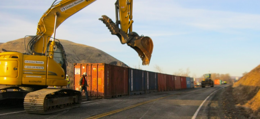
The Washington State Department of Transportation has deployed shipping containers to create a rockfall barrier near the site of a growing fissure on a ridge high above I-82 near Yakima, Wash. Washington State Department of Transportation

Connecting state and local government leaders
State and local authorities continue to closely monitor the fissure near Yakima, Washington.
SEATTLE — Although Mount St. Helens has been making national headlines in recent days due to a swarm of earthquakes in the vicinity of the volcano in Washington state— seismologists say there’s no cause for alarm —there’s a more pressing geologic concern on the other side of the Cascade Range in Yakima, about 140 miles southeast of Seattle.
A large fissure opened up on a portion of Rattlesnake Ridge in recent weeks and there’s increasing concern that a slow-moving landslide could lead to a possible larger event, sending part of the ridge down hundreds of feet onto a local road, Interstate 82 and some nearby homes, which are under evacuation orders .
Drone footage shows the crack, which developed near a local quarry. Land below the fissure is moving about 1.4 feet per week.
In an effort to protect Interstate 82, the Washington State Department of Transportation has brought in large concrete-filled shipping containers to create a barrier. But The Yakima Herald notes , those barriers are there to protect against rockfall and aren’t sufficient to stop a larger landslide.
State and local authorities continue close monitoring of the ridge and its fissure.
“At the first sign of more movement or increased frequency of falling rock, we will close the highway,” the department wrote in a blog post .
The Pacific Northwest Seismic Network, based at the University of Washington, has installed portable instruments near the ridge , about 5 miles south of downtown Yakima.
According to a PNSN blog post:
On Tuesday, Jan 2, 2018, three six-channel stations (3-component broad-band and 3-component strong-motion) will be installed within 1 km of the landslide. We are coordinating our installation with a broad-band station to be installed about 2 km from the site by the State Geological Survey of the State Department of Natural Resources (DNR). eismic data will be made available to all interested parties through the PNSN web site. Special analysis techniques are being developed to help monitor any seismic signals generated by the landslide.
Washington state is no stranger to landslides. A large landslide in the small community of Oso , about 60 miles north of Seattle, killed 43 people in March 2014.
Michael Grass is Executive Editor of Government Executive's Route Fifty and is based in Seattle.

NEXT STORY: AF Research Lab pushes for HPC solutions


