Mississippi River Winter Floods to Test Government Response, Army Corps Defenses

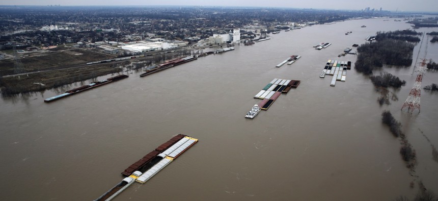
The flooded Mississippi RIver, south of St. Louis, seen on Dec. 31. Jeff Roberson / AP Photo
Levees are being checked for sand boils as water levels rise. And in Louisiana, there’s no word yet whether the Bonnet Carré and Morganza spillways will be opened.
While historic winter floodwaters in the St. Louis area began to fall over the weekend, the threat is not over for downstream communities along the Mississippi River. The U.S. Army Corps of Engineers, along with state and local governments along the river continue to be mobilized for what could be a strenuous few weeks as the flood crest moves south toward Louisiana and the Gulf of Mexico.
In Memphis, officials expect water levels to reach 41 feet, 7 feet short of levels seen during historic flooding in 2011. That flood event has provided valuable lessons for flood management in Tennessee’s largest city.
“We have all of our pumps that would take care of any floodwaters in place, we have barriers in place, we learned a lot from the 2011 flood,” Doug McGowan, the city’s chief operating officer, told WATN-TV. “There are some temporary barriers you can put around high value assets the area around the police and fire training academy there is a low-lying area there the new temporary barrier that we can install that will prevent water intrusion so that's a new capability that we did not have before.”
The Mississippi River reached flood stage at Natchez, Mississippi, on Saturday and has been rising steadily, about 1 or 2 feet per day, The Associated Press reported Monday.
The National Weather Service lowered the river’s forecasted flood crest at Vicksburg, Mississippi, to 52.5 feet and moved the expected high-water mark from Jan. 16 to Jan. 15, The Vicksburg Post reported Monday. During historic flooding in 2011, the river crested at 57 feet at Vicksburg.
Up and down the river, the Army Corps of Engineers and local levee boards have been on the lookout for sand boils, which form when water seeps through and bubbles up on the dry side of a levee. If the water is clear, the levee isn’t in immediate danger of failure. But, as KFVS-TV in Cape Girardeau, Missouri, reports, if “the flowing water contains significant amounts of material then the Corps surrounds the sand boil with a ring of sand bags to equalize the water pressure and stop any damage to the levee.”
In Louisiana, the state has prohibited all foot and vehicular traffic on levees along the Mississippi and Atchafalaya rivers, a move to help the Army Corps and local levee officials with inspections, The Times-Picayune reported Monday.
The Army Corps is currently evaluating its options for its major flood diversion infrastructure in Louisiana, including the Bonnet Carré Spillway, a mile-and-a-half-long floodgate upriver from New Orleans that can send water from the Mississippi into Lake Pontchartrain.
The goal, The Times-Picayune, reported is to keep flood levels at New Orleans to 17 feet. Mississippi River levees in the Crescent City are designed to accommodate flood levels up to 20 feet.
“It does seem likely there will be a Bonnet Carré Spillway opening this year,” said John Lopez of the Lake Pontchartrain Basin Foundation, according to WDSU-TV.
The Army Corps has also not decided whether to open the Morganza Floodway, a flood diversion channel upriver from Baton Rouge that can send water from the Mississippi River into the Atchafalaya River, which drains to the Gulf of Mexico. But doing so is not an easy decision since it requires the evacuation of residents and businesses in the floodway.
The Morganza Floodway was opened for the first time in 37 years during the 2011 floods, inundating 4,600 square miles of mostly rural land along the Atchafalaya River.
According to the Army Corps, flood protection infrastructure in the Mississippi Valley prevented more than $230 billion in damages during the 2011 floods.
Michael Grass is Executive Editor of Government Executive’s Route Fifty.
NEXT STORY: 4 Major Takeaways From Chicago’s Open Data Strategy


