New Series: The Geography of Disaster Risk and Resiliency in America

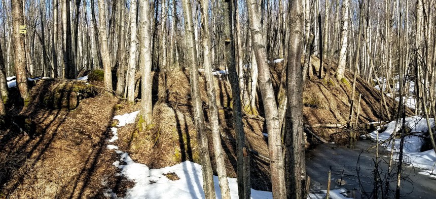
Earthquake Park in Anchorage, Alaska. Michael Grass / Route Fifty

Connecting state and local government leaders
Starting in Alaska and heading to the Lower 48, Route Fifty will feature locations that tell interesting stories about the dangers and disasters that our communities face.
This is the first in an ongoing series of Route Fifty dispatches examining state and local disaster preparedness, emergency response and resiliency challenges around the United States, starting in Alaska and the Pacific Northwest.
ANCHORAGE — It’s a natural landscape unlike I’ve ever—and I suspect you’ve ever—encountered. Large and angular chunks of land pushed up in a confusing manner, with birch and spruce trees and other vegetation growing up and out of the ground fractures.
It’s a bright and warm mid-April evening and there’s still some snow on the ground, but not too much to prevent me from exploring an unusual municipal park. Pools of water, some iced over, make navigating the fractured land challenging.
If you didn’t know you were in a place called Earthquake Park, you might not necessarily realize you’re in a landscape that was radically and suddenly reshaped in the span of five minutes during a massive disaster more than 50 years ago.
During the magnitude 9.2 Good Friday Earthquake in March 27, 1964, the largest seismic event ever recorded in North America, part of Anchorage’s Turnagain Heights neighborhood was destroyed when a bluff deteriorated and slid toward Cook Inlet, a few miles from downtown.
The land here dropped as much as 40 feet and slid as far as 2,000 feet away from its original location.

For being so large, that megaquake and tsunami only killed 139 people thanks to Alaska’s low population density. But it shows just how ferocious and destructive the forces of nature can be.
Following the 1964 disaster, the municipality left the land that would become Earthquake Park as is to be reclaimed by nature. An interpretive side trail, with detailed signs explaining how and why the ground failed, allows you to better appreciate the reality is the ground we stand on is not always stable.

It also serves as a reminder that disasters big and small can strike without warning and that state and local governments, working with federal partners and community stakeholders, have to be ready to respond.
In “The Geography of Disaster Risk and Resiliency in America,” an upcoming series of Route Fifty dispatches that will be part of a larger ebook, I’ll be featuring locations that provide snapshots of the very real dangers and disruptions that emergency planners, first responders, public officials and other stakeholders face, plus the strategies and technologies helping our communities be more resilient.
I’m starting in Alaska and will be heading into the Pacific Northwest. Since this part of the United States sits on the Pacific “Ring of Fire,” there will be many stories about volcanoes, earthquakes and tsunamis. But it’s also about landslides, flooding, wildfires, nuclear waste, sewage treatment and the continuity of government during a crisis. (I even hiked on top of a recent avalanche in the U.S. city most at risk for urban avalanches.)
Stay tuned for forthcoming Route Fifty dispatches.
Michael Grass is Executive Editor of Government Executive’s Route Fifty and is based in Seattle.

NEXT STORY: City and County Leaders to Trump: ONDCP Cuts Weaken Response to Opioid Epidemic


