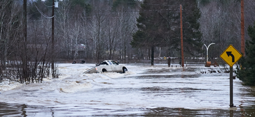
Can IoT protect communities when the next floods come?


Connecting state and local government leaders
With low-cost flood sensors, the Lower Colorado River Authority hopes to collect enough data that it can improve the accuracy of its flood predictions and geo-target alerts.
In the past month, there has been no shortage of examples of the damage flooding can do, whether it was causing a fire at a chemical plant in Houston after Hurricane Harvey blasted through the city or historic flooding in Jacksonville, Fla., after Hurricane Irma made her presence known. These events have given new credence to work on technology to better predict and alert officials to flooding dangers that has been top of mind for officials at the Homeland Security Department’s Science and Technology Directorate First Responders Group for some time now.
Last year, S&T partnered with the Lower Colorado River Authority (LCRA) on two flood management technologies. One leverages new, less-expensive internet of things sensors and the other sends geo-targeted alerts.
“Part of the project is to develop low-cost flood sensors that would let us collect more data from more places,” said John Miri, LCRA chief administrative officer. “The flood sensors we have now are great, but they’re very expensive, so that means we only have 270 of them and 600 miles of river."
Deploying low-cost flood sensors would allow researchers to get more sensors in more places and improve the data. But then, Miri asked, "what do you with the data? How do you build alerting and warnings for the public that are targeted and meaningful and really get people out of harm’s way?”
LCRA currently uses scientific-grade sensors that have full weather station capabilities -- the same kind the National Weather Service uses, Miri said. They measure how fast water is moving and use hydrological models to figure out what the water may do based on their touch points. The lower-cost option S&T and LCRA are working on would measure changes in water level. “Those are a little less sophisticated of a metric, but if you can get a sensor for $1,000 instead of $25,000 or $50,000, that adds a lot to the picture of how you’re collecting data,” he said.
The geo-targeted alerts would make it easier for mayors or city emergency operations coordinators to plan evacuations in areas floods are most likely to hit. Typically, decisions about evacuations are all-or-nothing, but when coordinators are dealing with cities like Houston, which has a population of 2.3 million, it’s tough to say all those residents need to leave.
“What we’re hoping -- if we can accomplish this vision of the geo-targeted alerting -- is that mayors or city officials don’t have to make an all-or-nothing decision,” Miri said. “They can use micro-targeting and a more sophisticated computer system to say, ‘What if we just started evacuating only the people who were really facing a high risk of danger and only 10,000 people every three hours so that the roads aren’t clogged up?’”
Although the sensors and alerts would work together “in the big ecosystem of how you keep people safe from floods,” he said, different organizations would be responsible for them. The sensors would be used by groups such as LCRA that are on the ground collecting data, while the alerts would be in the hands of frontline emergency managers.
DHS is still figuring out which jurisdictions will receive the low-cost sensors, Miri said, but LCRA will get some to test in three environments: an urban center such as Austin, a rural area with varying terrain and a location near critical infrastructure.
“If an electric substation gets flooded, that’s a pretty terrible event,” he said. “When water is coming, we need to de-energize those portions of the power grid, because if they stay energized when the water hits it, people could die.”
Without real-time data, however, LCRA must de-energize a station well in advance of the water’s arrival, leaving people without power who may need it for flood preparations or evacuation. With low-cost sensors closer to the stations, the authority could leave the power on longer but still shut it down before danger strikes, Miri said.
S&T expects to receive 300 sensors for deployment, testing and evaluation by early 2018, but Miri said the projects are likely to continue for a couple more years.
DHS is working on several flood response projects. Earlier this year, the department made several awards worth about $750,000 each:
- Physical Optics Corp. will develop a real-time flood forecasting and reporting system.
- Progeny Systems will build 100 units of a ruggedized, low-cost flood inundation sensor for alerts, warnings and notifications to responders and citizens using IoT wireless emergency alerts.
- Evigia Systems will work on a highly reliable, modular and cost-effective wide-area flood sensor network system.
NEXT STORY: Combating Child Abuse: States Take Action


